|
a walk along the Caldon Canal Hanley Park
|
Hanley
Park
|
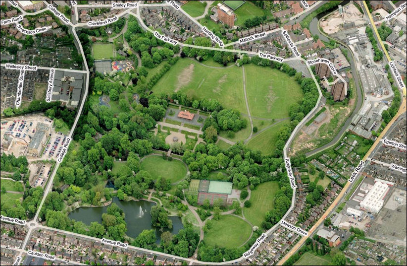
Caldon Canal divides Hanley Park in two. The canal was opened in 1779, the park over a hundred years later in 1897.
Hanley park officially opened on Jubilee day, June 20th 1897, occupies about 63 acres (25.5 hectares) of land. Originally a large area of waste ground called 'Stoke Fields', cut in two by the Caldon Canal.
|
|
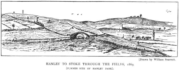
This drawing from a book written in 1906 by William Scarratt called "Old Times in the Potteries" illustrated the area called 'Stoke Fields' which was purchased to build Hanley Park. A footpath from Stoke to Hanley is running diagonally across the picture and the path crosses the Caldon Canal over the bridge. This area was described:
|
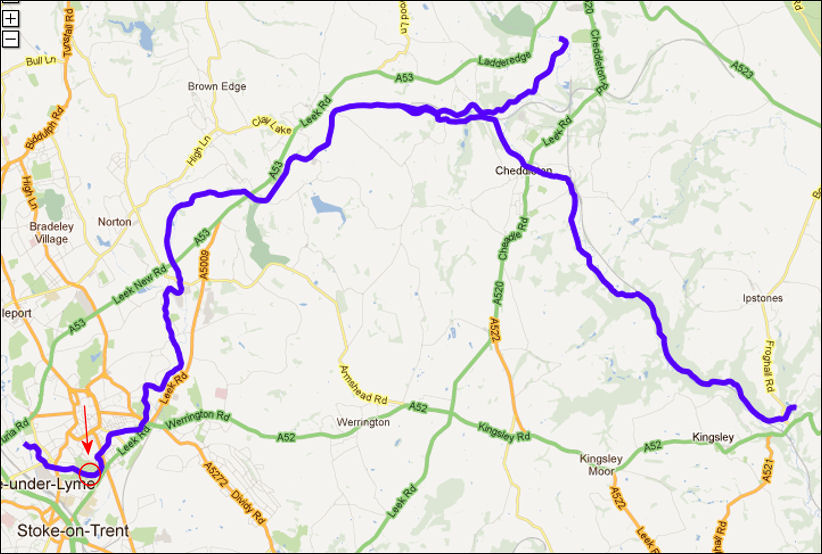
the route of the Caldon Canal
from Etruria to Froghall

Hanley Park on the Caldon
Canal
Google Maps
![]()
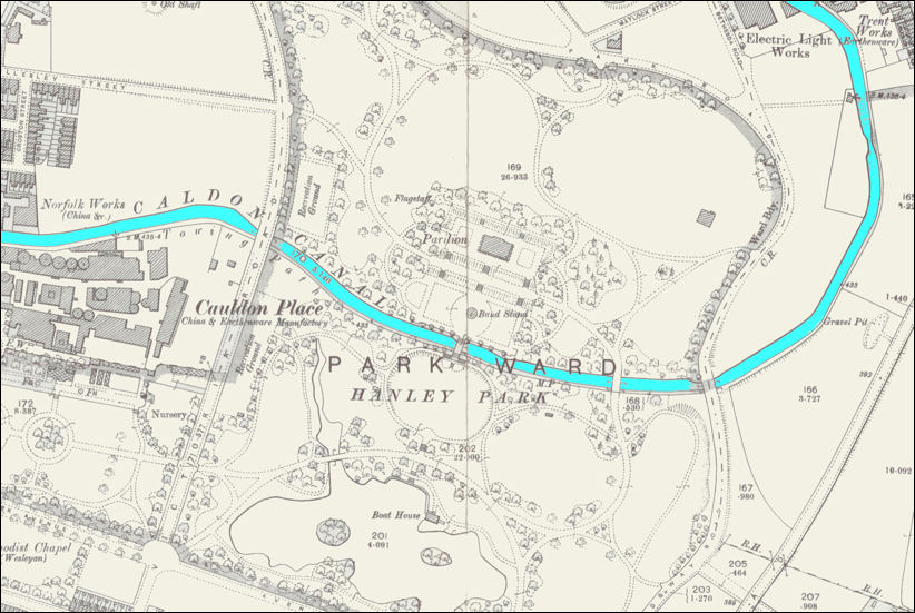
Hanley Park - 1898 map
the Caldon Canal passes as a feature through the park
The
Cauldon Place pottery works of Brown-Westhead, Moore & Co. is on the left of
this map.
On
the left is Victoria Road (renamed College Road inthe 1950's)
On the right is Ridgeway Road
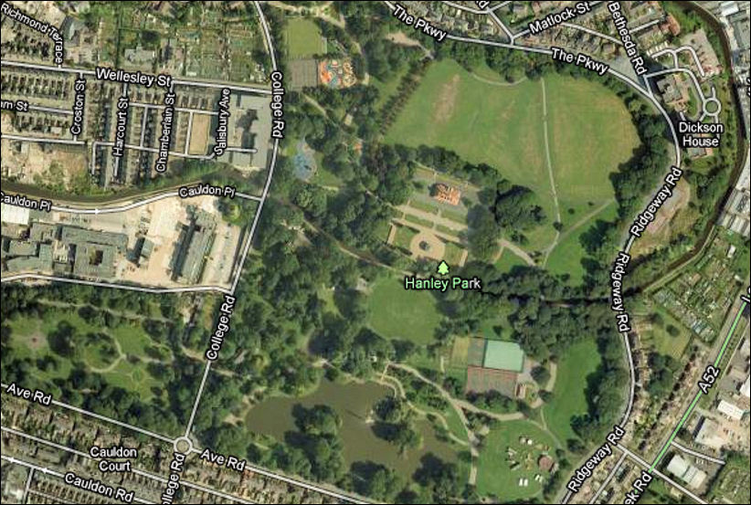
similar view c.2010 as
the 1898 map above
Google Maps
![]()
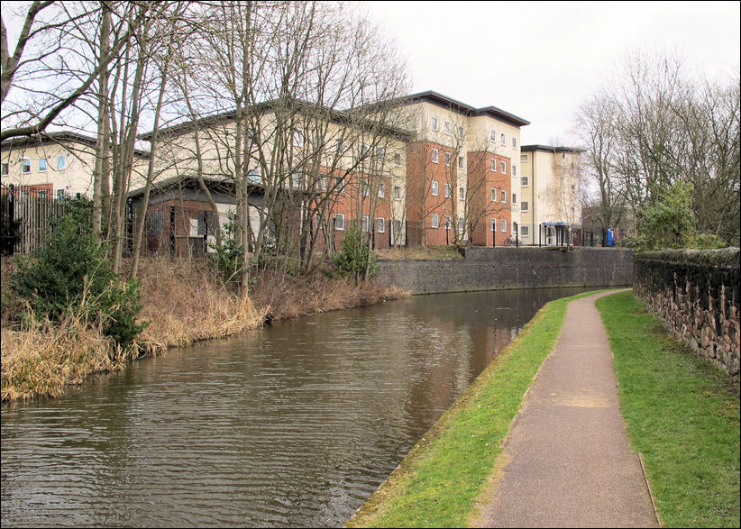
Student Flats on College Road -
on the far left of the photo is 'Arthur's Garden' on Chamberlain Avenue
view of the canal from
'Arthur's Garden'
![]()
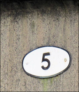
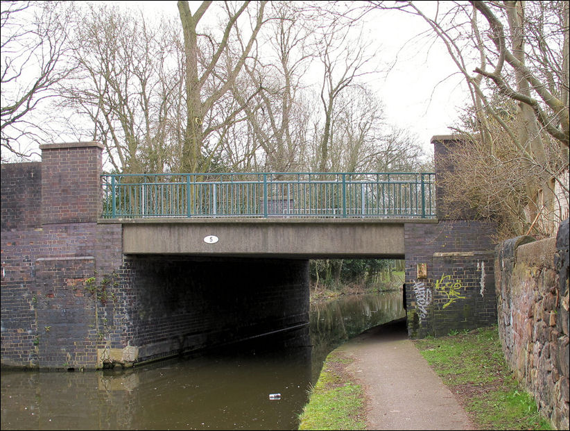
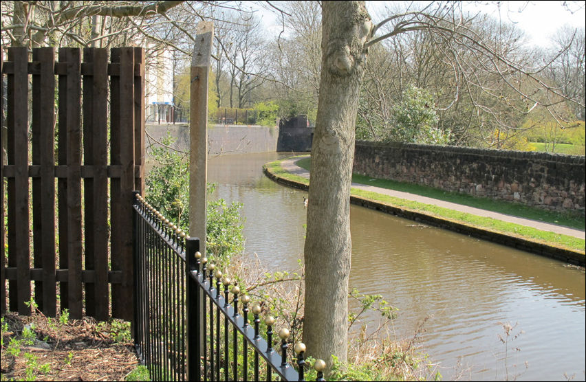
Bridge No. 5 marks the start of
Hanley Park - College Road runs over it
![]()
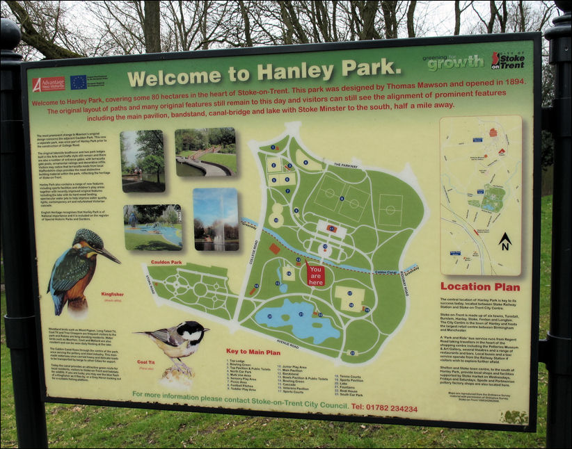
Welcome to Hanley Park
|
Thomas Mawson, a landscape architect who later developed international distinction, designed Hanley Park - this was one of his early commissions.
From 1910 to 1924 Mawson lectured frequently at the school of civic design, Liverpool University In 1923 he became president of the Town Planning Institute, and in 1929 the first president of the Institute of Landscape Architects. |
![]()
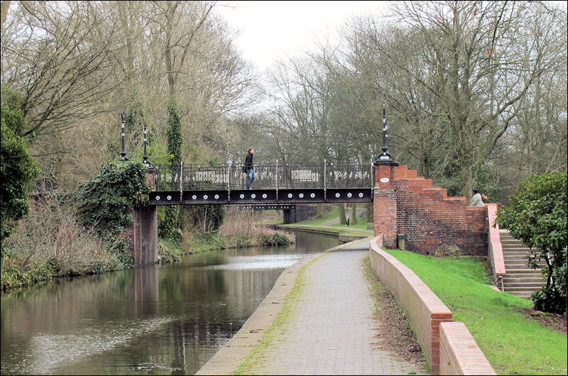
Bridge No. 5a - and in the
distance bridge 5b
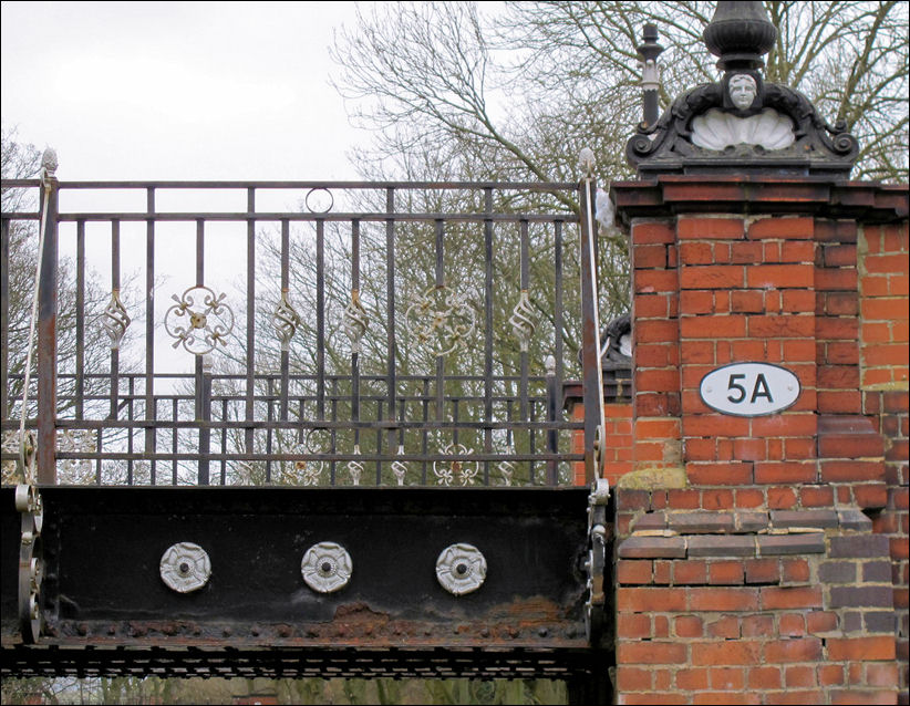
despite continued neglect the
bridge still retains some of its Victorian splendour
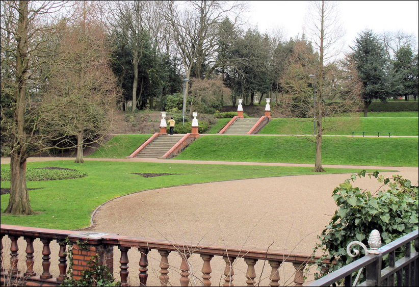
the terraces from bridge No. 5a
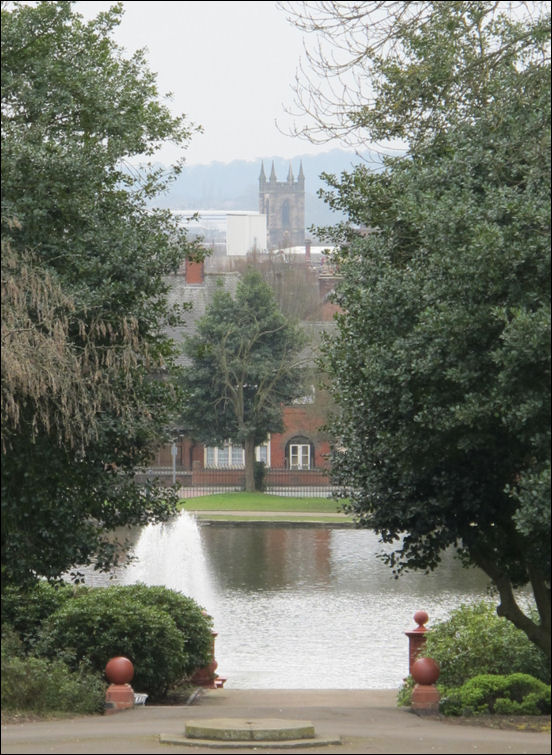
to the south of the bridge is
the boating lake and in the distance the tower of Stoke Minster
The boating lake was filled with water from the
Cauldon Canal,
and the park opened on Jubilee Day, June 20th, 1897.
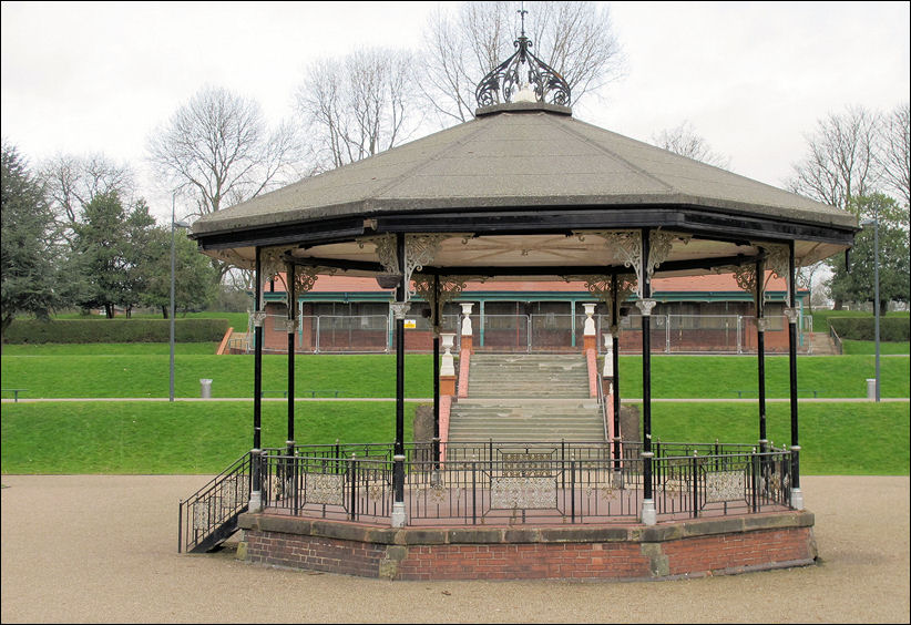
to the north is the bandstand
and pavillion
|
This bandstand and pavilion are situated in the middle of Hanley Park. It is the largest park in the City and covers an area of over 62 acres. The bandstand was the benefaction of George Howson (1818-96). A Chartist sympathiser. Methodist and a pottery manufacturer at the Eastwood Works, Hanley. He was associated (along with J W Powell) in the development of music in the area. He founded a scholarship for North Staffordshire students in the Tonic Sol-Fa College, London |
![]()

in the early morning sunshine -
footbridge No. 5b
in the background is bridge No. 6 - to the right is a canal milepost
![]()
the canal as it passes through
Hanley Park
Bing Maps
![]()
![]()
![]()
![]()
Next: Mousecroft and
Westwood
Previous: Cauldon Place
Bridge
|
related pages Arthur's Garden, Chamberlain Street, Shelton Neville Malkin's tour of the Potteries - Bandstand & Pavillion at Hanley Park |