|
|
| Stoke-on-Trent Districts: Lane End |
![]()
![]()
Previous: Lane End and Longton
Next: Potworks, Collieries & Churches
Maps showing the difference in
location of Lane End & Longton.......
|
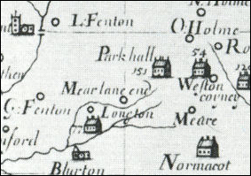
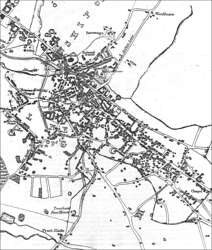
Location of Lane End and Longton: See the 1775 Yates and the 1832 Hargreaves maps below. Lane End was centred at the bottom of Wood Street and Anchor Street (now Anchor Road), and was roughly contained in the area surrounded by The Strand, Commerce Street and Market Street (then called High Street). Longton was centred on Mill Street (previously Green Dock Lane and now Edensor Road) and Trentham Road.
|
Thomas Hargreaves map - Lane End
and Longton in 1832
This map was published in 1832. Note that the top area is named "Lane End" and the bottom area named "Longton", the combination of the two areas into one and assuming the Longton name did not occur unit the early 1840's.
The hand drawn lines surrounding most of the built up area are the parish boundaries, most of the growth of the town had taken place within the boundaries of the parish of Stoke-upon-Trent.
Most of the land on the borders of the parish was the property of the Marquess of Stafford, later the Duke of Sutherland, of Trentham Hall.
![]()
|
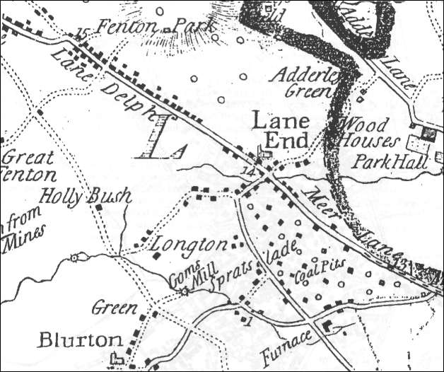
Mear Lane End and the development of Lane End "......... has long been one of the main ways of access into North Staffordshire from Derbyshire. It was on this road, roughly at the point where the Anchor Brook and the stream from Goldenhill meet, that the hamlet of Lane End or Meare Lane End grew up in the late 17th century under the influence of coal and ironstone mining and ironworking. In 1666
13 houses in Longton were chargeable to Hearth Tax and 12 in Meare Lane
End. Tracks led south-eastward from Meare Lane End to Stone and northward over Sandford Hill to Hanley, Adderley Green, Leek, and the north-east of the county by the 18th century. The turnpiking of the Newcastle to Uttoxeter road under an Act of 1759, of the road to Stone under an Act of 1771, and of the road to Adderley Green under an Act of 1813 greatly facilitated the growth of Lane End. By 1775 there was a nucleus of houses at the junction of the roads and for a short distance along these three roads and along the road to Longton Hall which joined the Stone road just south of the centre of the village.
There were in addition a number of scattered houses and numerous coal pits between the Uttoxeter road (then called Meer Lane) and the Stone road. In 1784 Lane End was still small enough to be called a village, although it was fast developing as a community. The first school was built c. 1763 and the first church in 1762, and in 1789 the market-square (now Times Square) was laid out at the junction of the Uttoxeter and the Stone roads. By the end of the century there was a network of streets in the centre of the town forming a built-up area bounded by Market Lane (now Transport Lane), the Stone road, the Uttoxeter road, and Commerce Street; the streets in this central area are now called Cornhill Passage, St. Martin's Lane, Cyples Lane, Kingcross Street, and Chancery Lane. By then, also, both sides of the Uttoxeter road had been built up for about half a mile from the town centre. In 1794 a second market-square (later Union Square) was laid out at the north end of Commerce Street." From: 'Longton', A History of the County of Stafford: Volume 8 (1963), pp. 224-246.
|
![]()
![]()
Previous: Lane End and Longton
Next: Potworks, Collieries & Churches
questions / comments / contributions? email: Steve Birks
18 November 2007