|
Normacot, Lightwood Road and the Iron
Furnace
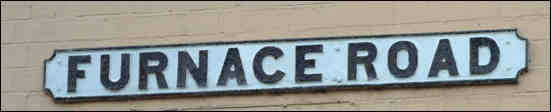
The street name "Furnace Road" and the location
"Furnace" on the 1775 Yates map of the Normacot area are a reminder of the
industrial heritage of the area.
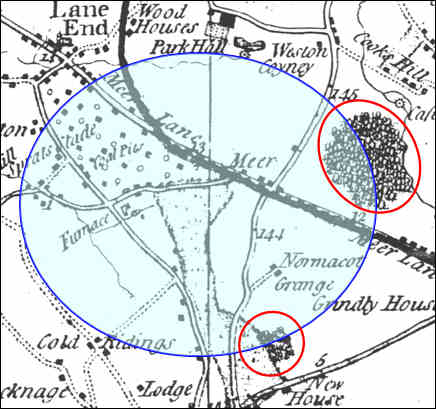
Normacot from Yates 1755 map
showing the location of "Furnace" and the wooded areas (red circles)
“Blurton
is a pleasantly situated village, two and a half miles E of Trentham,
comprising within its chapelry (to Trentham) the enclosed district
called Lightwood Forest, and the hamlets of Cocknage, Cold
Ridding, and Spratslade, the latter of which forms a suburb of cottages
adjoining Longton.”
1851
Directory
Lightwood Forest
occupied the whole of the eastern side of the township of
Blurton in the parish of Trentham.
It stretched from Lane End in the north to Rough Close in the south
and at the beginning of the 18th century occupied an area of 650
acres. In the 16th century the forest was probably much larger.By
the 1660s there were about a dozen cottages on the edge of Lightwood
Forest.
The Trentham parish registers list the occupations of the
parishioners. In the 1720s fifty separate entries can be identified
in the registers. The two largest groups were colliers (19) and
Labourers (19). The remaining 12 entries included two carriers one
of whom is specifically described as a "coal carrier" and Randle
Blackshaw "clerk of the Furnace" who died in 1729.
The vast majority of these cottagers were employed in the coal
and ironstone mines developed in the 17th century by the Foley
family of ironmasters. By the 18th century the "Meir Heath Colliery"
was in the possession of Lord Gower, of Trentham Hall, who was
working 19 mines in the area in 1787.
These "Coal Pits" and ironstone mines are depicted on the 1775
Yates map in the vicinity of the "Furnace". |
Meir Heath Iron
Furnace
The combination of water power, iron and limestone, and wood for
charcoal ensured that Normacot was an early place of iron working in
Staffordshire.
The first ironworks on the site was probably that leased by the
Leveson family of Trentham Hall to John Oldcoath of Talke between
1580 and 1598.
Operations appear to have resumed in 1610 when the furnace was
worked by Thomas Hunt, son of John Hunt, who held Longton Manor. He
was declared bankrupt in 1647 and a few years later it had been
acquired by the Foley family of ironmasters who also bought the
Manor of Longton in 1651.
Under direction of the Foley's the output at the Normacot furnace
increased from 300 tons of pig iron per annum in the decade 1690-99
to 600 tons per annum in 1717.
This has been calculated at 2.5% of total national output. Despite
the scale of this enterprise its period of prosperity was brief.
But its impact on the landscape cannot be over estimated. The
Ludwall spring was dammed to provide a pool for powering bellows and
forge hammers. Most of Lightwood Forest was cut down to provide the
vast quantities of charcoal required by the furnace. Numerous pits
were dug all over Meir Heath to provide ironstone and waste product
was dumped all over the surrounding area. By c.1770 when coke-fired
blast furnaces were introduced the Normacot furnace had ceased
operations. |

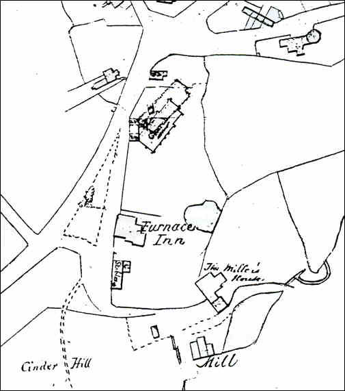
1846 map of the centre of
Normacot
The road running diagonally across the left of
the 1846 map is the present Belgrave Road and Meir Road. The location of the
Church of the Holy Evangelists is marked on the map although not yet built.
Furnace Inn is clearly marked and is a reminder
of the former industrial activity in this area. Furnace in was about to be
converted into the vicarage for the new church.
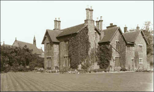
The old vicarage, Normacot - Formally the
Furnace Inn
photo - 1920's Lovatt Collection
In the background can be seen
the Church of the Holy Evangelists
Change of name:
This area had always been known as "Furnace" or "Mear Heath" - see the Yates
and other old maps, because of the rural nature and the iron smelting
furnace.
From the 1830's as developments were made the names fell into disuse and
were replaced by the name "Normacot"
 
next: The need for water
previous: Normacot on the maps |