Maps of Stoke-on-Trent & North Staffordshire
![]()
Maps of Stoke-on-Trent &
North Staffordshire
![]() | main
map index |
| main
map index |
1878 OS map of Peel Street Dresden, (Longton)
1878 OS map of Peel Street Dresden,
(Longton)
| 1881 census returns for Peel Street |
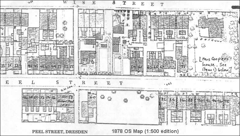
PEEL STREET, DRESDEN
Above is a reduced version of the 1:500 edition of the same map showing part of Peel Street.The street was named after Robert Peel, the leader of the Conservative Party, popular with the Liberals because he was responsible for the repeal of the Corn Laws.
The map illustrates the progress of building development. Streets were formed by the Dresden & Longton Freehold Land Society which allocated building plots to members but it was their responsibility to construct the houses.
Some building plots remained empty for years and were cultivated as allotment gardens. Plots frequently changed hands. Virtually all the houses in Peel as in the adjoining streets were terrace houses though as the advertisement points out "of a good class" each with its own front garden and back yard.
The occupiers of these houses in 1881 are listed on the census returns. Thomas Cooper built a large villa at the end of the street probably because the site faced the Anglican Church. The house was offered for sale in the Staffordshire Advertiser on 13 March 1869. It was demolished in the late 19th century and replaced by terrace houses.
| See full map of Dresden in 1878 |
|
- take a 'walk' around this area |
| 1881 census returns for Peel Street |
![]()
![]() | main
map index |
| main
map index |