Maps of Stoke-on-Trent & North Staffordshire
![]()
Maps of Stoke-on-Trent &
North Staffordshire
![]() | main
map index |
| main
map index |
the Christchurch area of Fenton
- extract from 1924 OS map
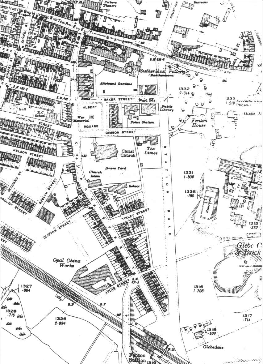
Extract from 1924 OS map - the Christchurch area of Fenton
This map shows a lot of development over the 1878 map.
The Christ Church shown is the 1890 replacement of the original 1838 church which was demolished because of subsidence caused by the nearby Glebe Colliery.
The area around Church Street is now extensively laid out with streets and houses.
The town hall, police station and war memorial around Albert Square are now built.To the left is the Glebe Colliery and brick works.
At the top of the map is Fenton House the grounds have been reduced by the building of Station Road..
| compare with 1878 map of same area |
|
- take a 'walk' around this area |
![]()
![]() | main
map index |
| main
map index |
28/01/2003