|
|
|
Etruria Park |
|
|
|
|
|
Etruria Park |
|
|
![]()
![]()
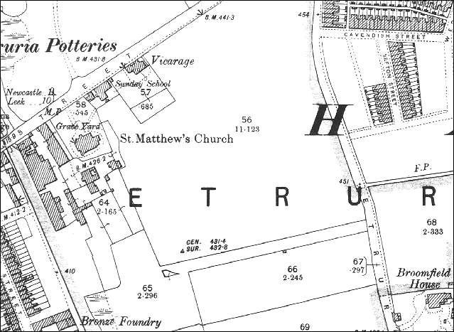
The area around Etruria Park The park was built next to
St. Matthews church on a triangle of land between Lord Street, Etruria
Vale Road and the Trent and Mersey Canal.
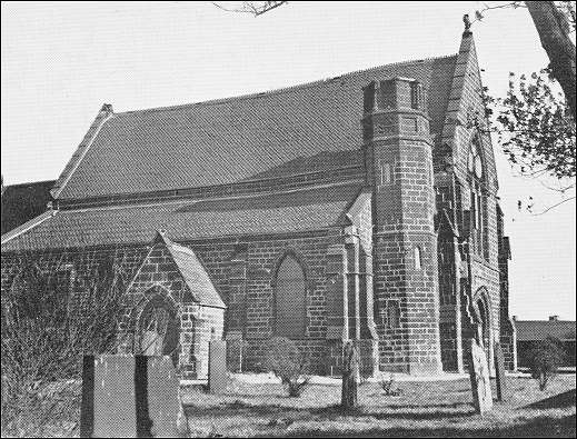
The church was designed by Henry Ward and Son of Hanley and stood at the corner of Etruria park. Subsidence, due to mining, has been a problem in Etruria. By the early 1950's there was a drop of two feet ten inches from west to east in the church and and eighteen inch drop from north to south. In 1938 the escape of expanding air from the mine workings caused "a deluge of tiles" to fall from the walls onto the choir. One day the Rev. Horwood was in the church and there was a noise "like the rushing of a mighty wind" and he was a column of water rising at the end of the church to a height of fifteen feet. By 1960 most of the walls were out of the perpendicular and had been secured by iron ties. Two of the stone arches of the nave were supported on wooden strutting. Later the church was demolished because of its poor condition.
|
previous: the streets around the park