Berry Hill (Stoke-on-Trent)
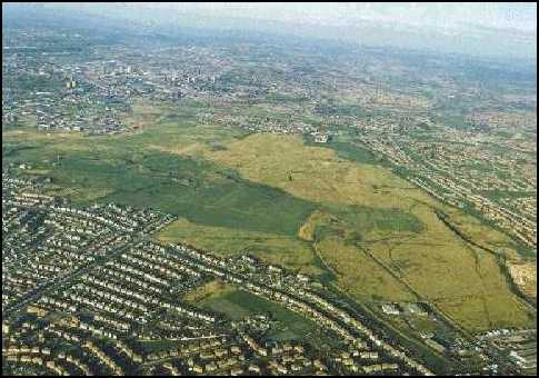 The Berryhill fields cover the vast majority of the picture. The estate in the foreground is Sandford Hill which also covers a wide area. |
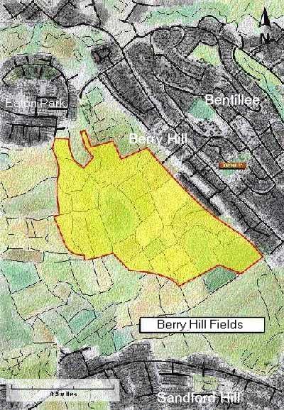
Berryhill
fields is the largest area of open space in the city. It is linked to
nearby Park Hall country park by the Moss field greenway and therefore
represents a significant recreational resource for a large proportion of
the city's urban population The landform
is a result of extensive coal mining and tipping in the past and today as
a moorland type character with wildlife in abundance. Bird life abounds
and includes Skylarks , reed buntings, grey partridge and song
thrushes-all nationally threatened species but thriving in their new
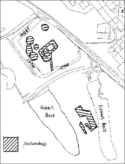
habitats. There is still evidence of a 13C. MOATED MANOR |
|
|
|
The Berryhill Fields Millennium project will transform the 68 hectare derelict sight of a former open cast coal mine into a innovative community nature park. The £2.7 million nationally funded environmental project will be completed by the year 2000 to provide an enduring city landmark for the next millennium. Berryhill
Fields is surrounded by housing; the Changing Places Project will
therefore provide a sustainable community open space conserving and
enhancing the existing ecology and archaeology. The site will become a
major focus for informal recreation and environmental education. Phase one treatment of 52 pit shafts was completed in March 1996
|
 |
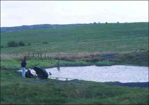
Fishing at 'Tiddlers Pool' on the Berry Hill fields. |
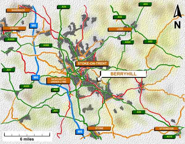
Berry Hill is situated on the right hand side of Stoke-on-Trent. The whole of the right hand side was an extension to the borough boundary in 1922. The following areas were added in 1922: Chell Heath, Norton-in-the-Moors, Smallthorne, Milton, Abbey Hulton, Bcknall, Bentille, Meir and Lightwood. |
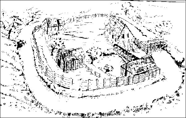
A reconstruction of Berry Hill Manor from the archaeological evidence at Berry Hill and written evidence from manors. |
![]()
If you want to print this page out then set the print to landscape.


[ Comments / Questions? email: Steven
Birks ]