![]()
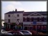
St. John's Square (Burslem) Stoke-on-Trent
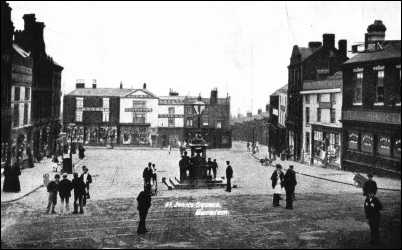
![]() The layout of central Burslem today still has the street plan of a medieval
market town. The area of St. John's Square can be seen on a 1720
map. An 1818 trade directory records "St. John's
Square, near new Market place."
The layout of central Burslem today still has the street plan of a medieval
market town. The area of St. John's Square can be seen on a 1720
map. An 1818 trade directory records "St. John's
Square, near new Market place."
| From
the 1818 Trade directory we know that the following professions and
trades were carried out in St. John's Square:
(Note that many carried out more than one
trade) (Note - the Star inn is more properly located
in Queen Street, and is so in the 1851 directory)
|
||
| Crate Maker: | Thomas Oakes | |
| Grocers: | Thomas Oakes | |
| Inns & Taverns: | Thomas Adams Hannah Sheldon Thomas Hargreaves George Lowe Thos. Machin |
Bull's Head Duke William Mason's Arms New Inn Star |
| Iron Mongers: | Joseph Wade | |
| Surgeons: | Charles Rawlings | |
| The
rapid development of the importance of St. Johns Square can be seen from this listing in Whites
1851 Trade directory:
(Note that many carried out more than one
trade)
|
||
| Agents: | Geo Jackman Rutherford | |
| Bakers and Flour Dealers: | John Ledsham William Wright |
|
| Boot and Shoe Makers: | Charles Gerard | |
| Chemists and Druggists: | Thomas Blackshaw George Hawthorne |
|
| Confectioners: | Joseph Edge John Ledsham |
|
| Eating Houses: | Mary Walker | |
| Fire and Life Offices: | Anchor, G.
Hawthorne
William Dixon |
Representing
Clerical Medical and General.
Representing National & Mercantile. |
| Glass & China Dealers: | William Tomkinson | |
| Grocers and Provisions: | William Dixon Hill Chas, James Thomas Kenderdine John Ledsham |
|
| Hairdressers: | William Tomkinson | |
| Hatters: | Lazarus Salisbury | |
| Inns and Taverns: | James Mann James Lockett Geo. Jackman Rutherford John Whittle |
Bull's Head Duke William Freemasons Arms New Inn |
| Linen & Woollen Drapers: | John Cook | |
| Watch & Clock Makers: | George Slater | |
![]() Arnold Bennett in his novels used The Potteries,
especially Burslem as a thinly disguised location. He re-named St. John's Square
to St. Luke's Square.
Arnold Bennett in his novels used The Potteries,
especially Burslem as a thinly disguised location. He re-named St. John's Square
to St. Luke's Square.
|
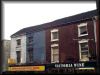
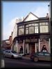
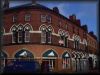
The buildings at the bottom are (left to right) Longson's, Lovatt's (Tailors & Outfitters) and The Masons Arms. The street at bottom right with the terraced houses visible was Hanover Street - this street and the area around it has been cleared and now Woodbank Street replaces it and forms part of the Burslem ring road. |
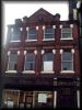
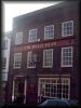
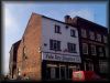
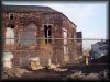
| Photographs
around St. John's Square (From the turn of both the 20th and 21st Centuries) |
|||
|
|
|
 Home & Colonial |
|
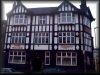 Duke William Inn
|
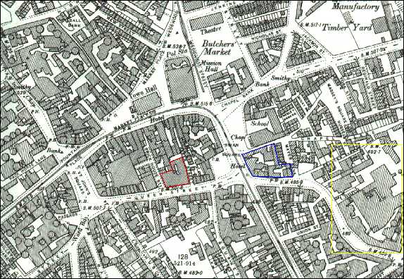
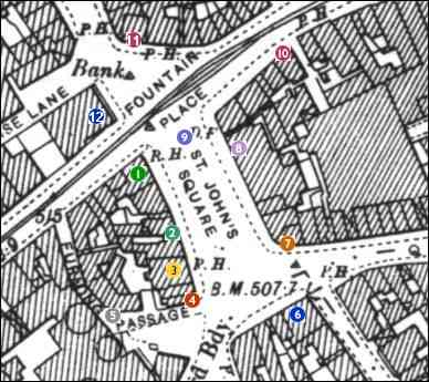 St. John's Square from a 1898 O/S Map See More of Map |
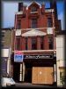 1889 Shop
|
|
|
|
 'Baines' family home |
||
![]()
Burslem Photo Index | Burslem 1898 Map
![]()
![]()
[ Comments / Questions? email: Steven Birks ]