Waterways of Stoke-on-Trent - Burslem
Branch Canal
![]()
![]()
![]()
| Burslem Branch
Canal Index |
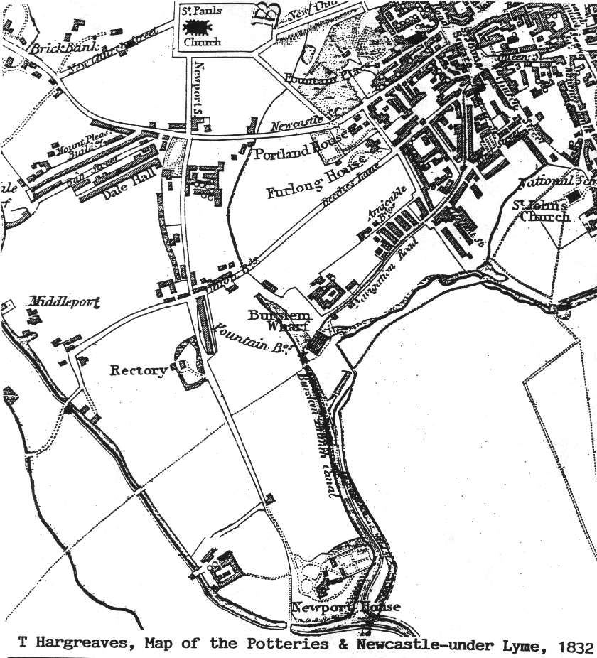
From: "T Hargreaves, Map of the Potteries and
Newcastle-under-Lyme, 1832"
| This map
shows the start development of the area around the canal from its
completion in 1805 to the date of this map (1832). Newport House and the
associated Newport Works - pottery factory are situated on the canals
(the works on the Trent and Mersey and the House on the Burslem branch). The horse-drawn tramway along navigation road to St. Johns Square is shown. |
![]()
![]()
next: 1851 OS map of the canal area
![]()
![]()
next: 1851 OS map of the canal area
| Burslem Branch Canal Index | aerial photo and map of the canal area |