![]()
|
|
|
|
Barry Sillitoe's photos around
Burslem, Stoke-on-Trent
|
With the exception of the V. E. celebrations photograph these photos were taken by Barry Sillitoe in the late 1960s / early 1970's. Barry was born in Burslem in 1940. His son Mark recalls "he grew up on Lincoln Rd, behind Waterloo Rd (where my Grandparents had a little shop) I remember going to visit my Grandparents when The Grange was all being bulldozed and was just dirt - probably 1972/3 ish - My grandparents had then moved and lived above the Post Office, a damp old place. I remember 3 smells in Stoke - on Commercial Street there was a brewery (DD I think), a bakery and the two oatcake shops opposite each other on Waterloo Rd" |
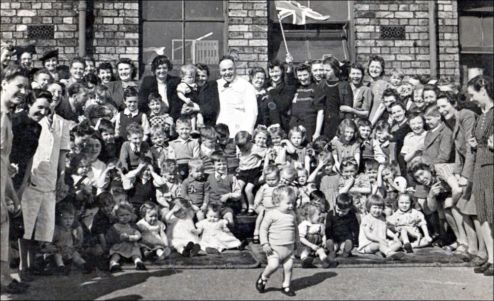
V.E. Day,
Burslem 1945
probably Moorland Road Primary School
Pack Horse Lane
|
"Originally the main route from Newcastle-under-Lyme to Burslem ran to Longbridge (renamed Longport following the arrival of the canal), then through Trubshaw Cross and followed the route of Newcastle Street for about half its length before running on a more northerly line to Pack Horse Lane in Burslem. This road was turnpiked in 1763 but by the early 19th century the Pack Horse Lane element was replaced with the present route of Newcastle Street, so that by 1828 Pack Horse Lane was sold off for development. Enoch Wood bought the stretch that ran through his Fountain Place Works and this is the only remnant of the original eastern half of the road."
|
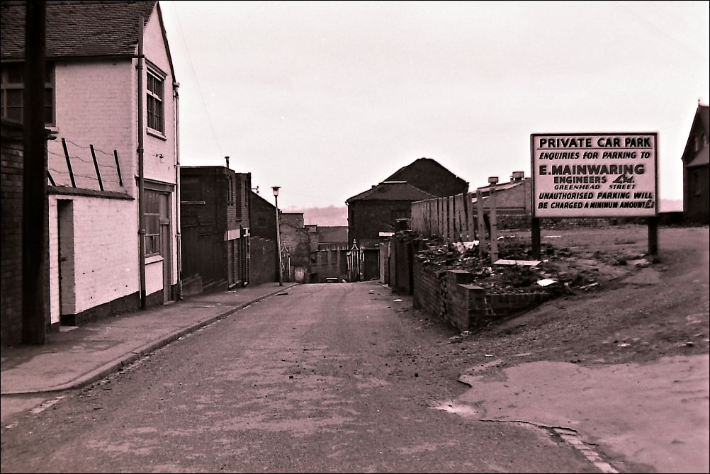
Top end of Pack Horse Lane
to the right is the car park
behind the former Fountain Place Works
to the left is the rear of the former National Westminster Bank
The car park sign reads:
Private Car Park
Enquiries for parking to
E. Mainwaring, Engineers Ltd
Greenhead Street
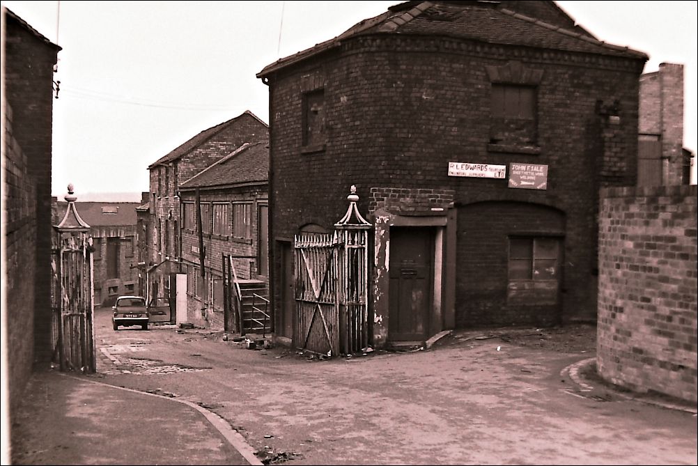
bottom end of Pack Horse Lane
The two signs read:
R L Edwards (Burslem) Ltd, Engineering Supplies
John
F Sale, Sheet Metal Works, Welding
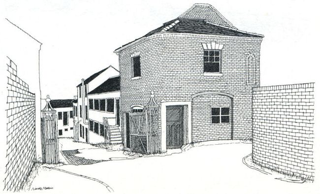
Packhorse Lane, Burslem
pen drawing by Neville Malkin - May 1975
by a remarkable coincidence
Neville Malkin made this sketch from the same location
that Barry Sillitoe chose a few years earlier - the buildings
are now demolished -
but the curved brick wall to the right remains (2025)
- more on Neville Malkin's sketches -
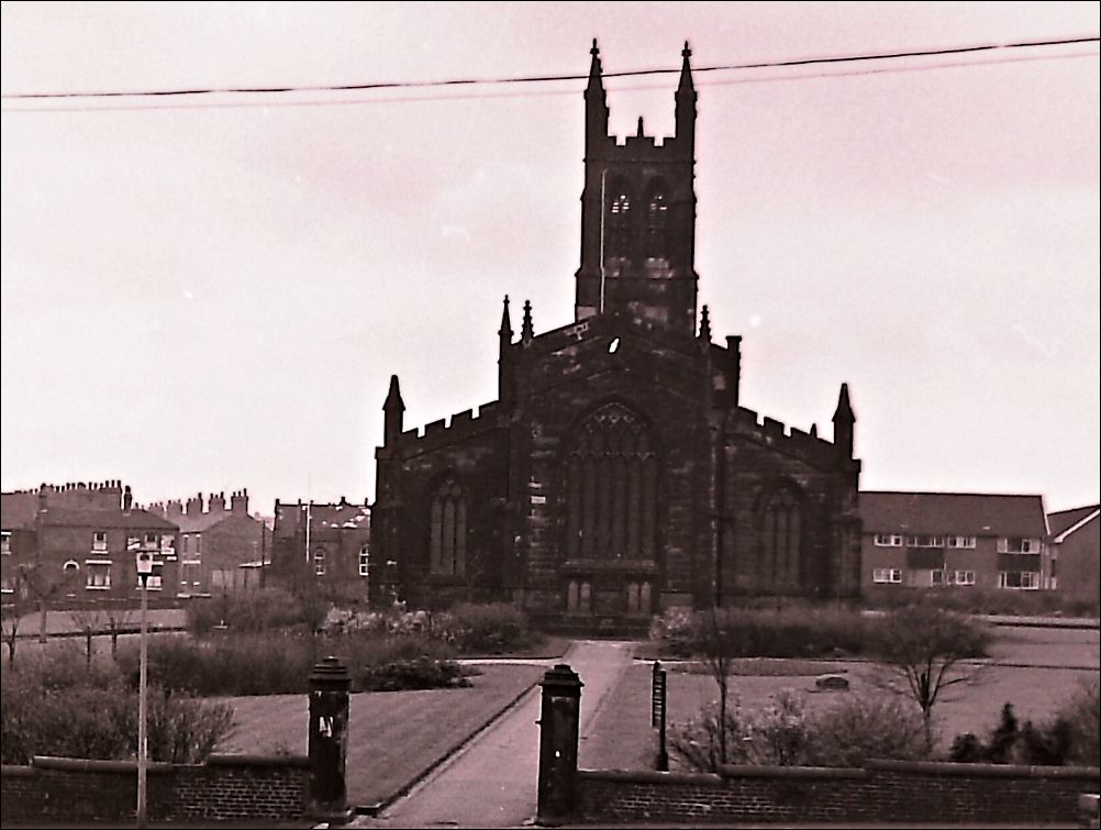
St. Paul's, Church Square, Dale Hall, Burslem
built 1828 demolished 1974
Described as a "large and
handsome Gothic edifice, with a lofty tower".
Due to subsidence this church was demolished in 1974
St. Paul's, Church Square, Dale
Hall, Burslem
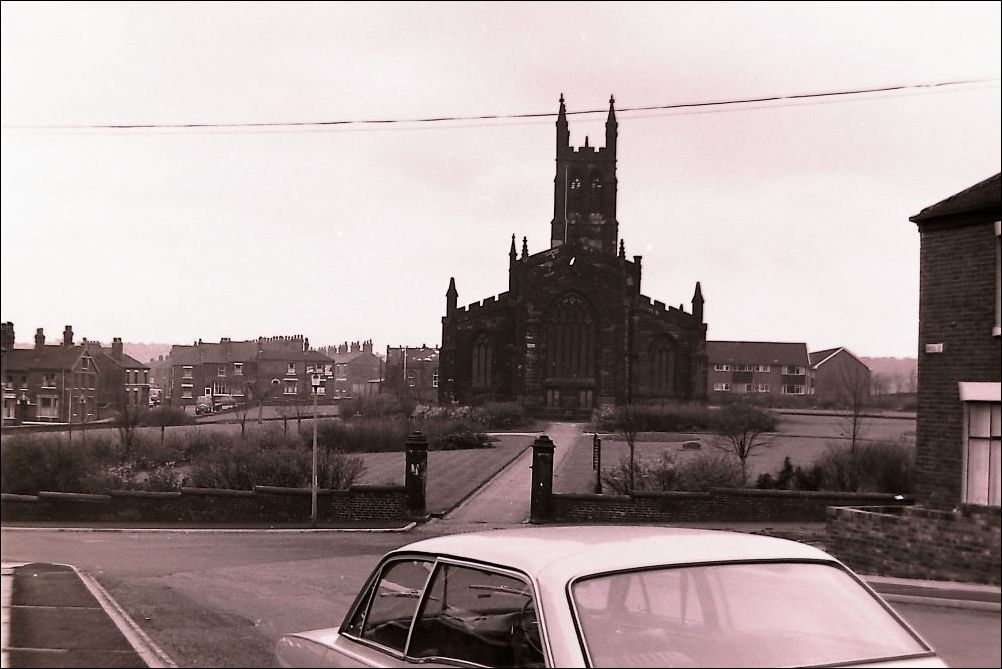
St. Paul's, Church Square, Dale
Hall, Burslem
this view is taken from the bottom of Hall Street
Hall Street runs parallel to
Newcastle Street, from what is now
Westport Road (was Liverpool Road) down to St. Paul's Church in Dale Hall
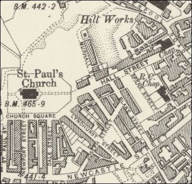
1900 OS map showing St. Paul's
at the bottom of Hall Street
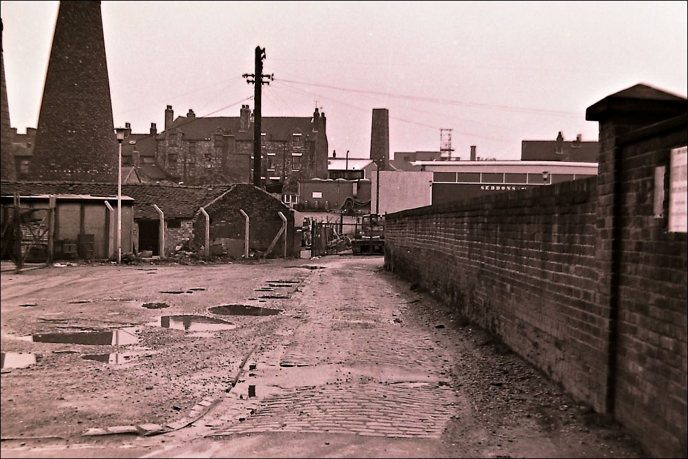
Bournes Bank
on the left can be seen the down draught kilns of Acme Marls
Once part of a packhorse road which ran from Hanley through Burslem and onto Tunstall and Church Lawton.
- more on Acme
Marls -
The remnants of the Potteries' Loop Line
|
In the early 1960s the loop line was in terminal decline and the 'Beeching Axe' signalled the final blow for passenger services, and services were withdrawn on 2 March 1964. The loop line track was allowed to fall into disrepair, and track lifting started early in 1967 starting from Waterloo Road in Hanley. By May 1968 all the track had been lifted. |
- index page for the Potteries' Loop Line Railway -
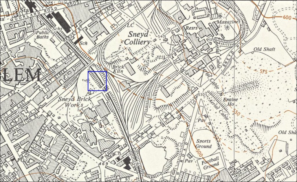
National Grid map - published
1955
The four photographs shown below
were taken standing on the bed of the removed loop line railway
the location is shown in blue in this map
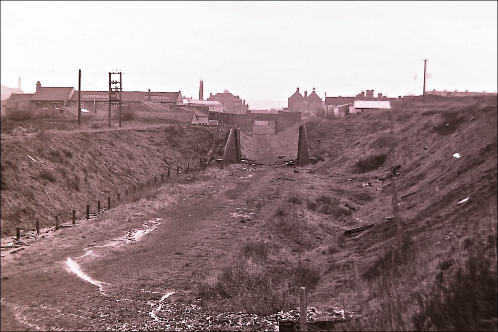
view towards Moorland Road
|
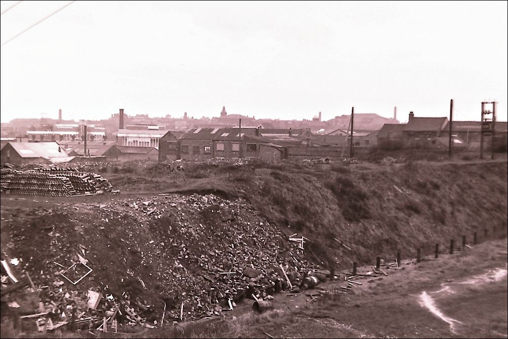
drainage pipes stacked up on
the Sneyd Brickworks site
|
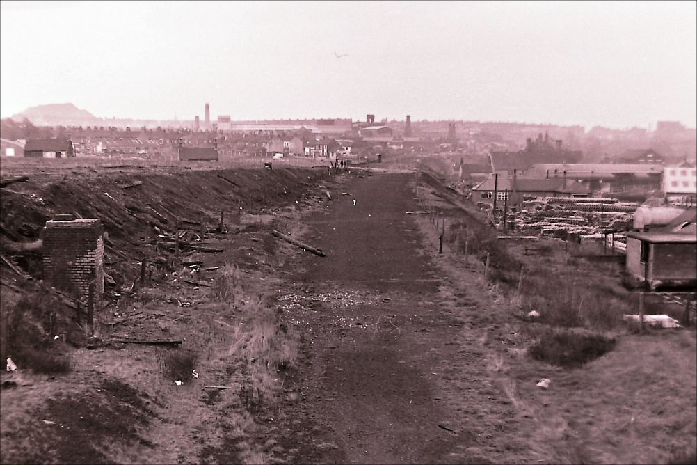
view in the opposite direction
looking towards Cobridge
|
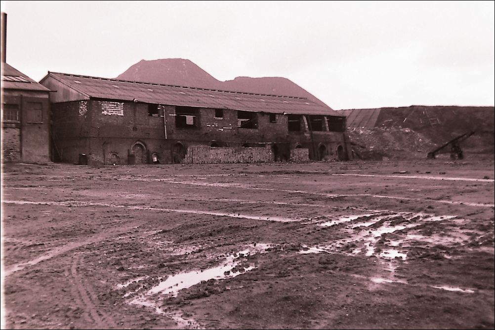
outbuildings of the Sneyd
Colliery & Brickworks
|
Page created 5 November 2025 |