![]()
|
|
![]() back to Stoke-on-Trent districts
back to Stoke-on-Trent districts
Districts
of the Stoke-on-Trent &
Newcastle-under-Lyme Conurbations
Botteslow
![]()
![]()
next: Northwood
Botteslow
|
The old Township of Botteslow covers the areas of Brookhouse Green, Eaton Park, Ubberley, Berryhill and Berryhill Fields. The Township of Botteslow was a liberty of 593 acres in the ancient parish of Stoke-upon-Trent bounded on the west by the River Trent and on the north and east by a small tributary of the Trent; to the south lay the township of Fenton Vivian. It is an upland area lying between 400 and 500 ft. and was devoted mainly to farming and coal mining.
Parochially Botteslow was part of the ancient parish of Stoke and manorially part of Fenton Vivian. Botteslow became part of the new parish of Stoke Rural in 1894 and of the county borough of Stoke-on-Trent in 1922.
Botteslow - A History of the County of Stafford Vol 8 |
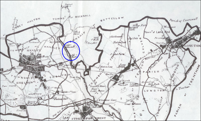
The location of Upper and Lower Botteslow - Ward's map of 1843
1837
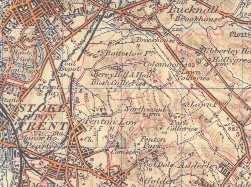
Ordnance Survey map - the general location of the Township of Botteslow
outlined in green
Victoria Road and Leek Road were not built until the early 1840's and so
are not on this map.
Brookhouse, Bury (Berry) Hill, Lawn, Holly Bush were all part of Botteslow
![]()
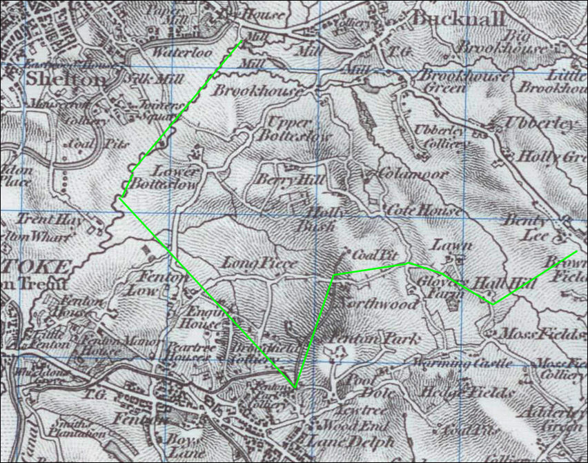
Township
of Botteslow - Ward's map of 1843
Victoria Road and Leek Road are shown on this map
Light
blue line is the River Trent
Dark blue line is the Caldon Canal
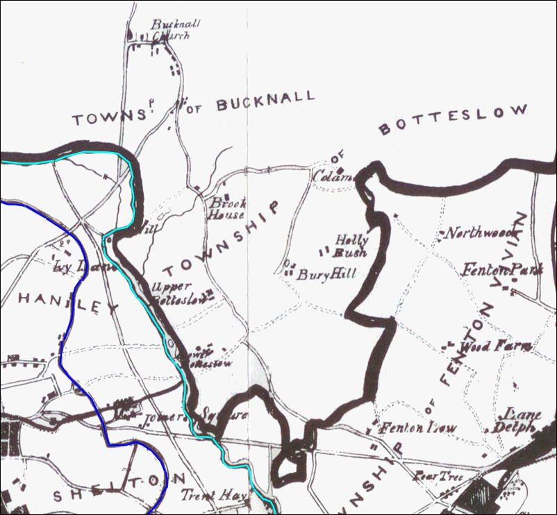
1902
Ordnance Survey map - showing Botteslow, Brookhouse, Berry Hill, Holly Bush
and Lawn
which were all part of the Township of Botteslow
|
The area is crossed by tracks which used to link the various farms, many of the tracks are still present today. The road from Fenton Low to the Berry Hill Brickworks and collieries was originally part of the track between Fenton and Bucknall - part of this track still exists as 'Fenton Road' It was then noted that Botteslow's 'roads are neglected and founderous' but they were the only way from Fenton to hanley and Bucknall. This track lost what importance it had with the opening of Victoria Road (originally called Fenton Road) from Fenton through the western end of Botteslow to Joiner's Square and Hanley in the early 1840's.
|
|
"BOTTESLOW, which adjoins to Fenton-Vivian, and... belonged formerly to that manor, is a hamlet of 593 acres, purely agricultural or pasture, but abounding with mines, at present little wrought. It is bounded on the west by the Trent, and consists of several farms, called Upper and Lower Botteslow, Bury-Hill, Holly-bush, Brookhouse, Colamore, Glover's-Farm, and Hall-Hill, belonging respectively to James Beech, — Tait, Thomas Kinnersly, William Taylor Copeland, Esqrs., Mrs. Carrington, and Lady Pilkington.
Botteslow has nothing of the character of a village ; the farm-steads being all detached ; the roads are neglected and founderous, in consequence of its not having had of late any resident proprietor.
The Lower Botteslow farm was formerly the seat of the Machins, one of the most ancient and respectable families of the parish, the male line of which terminated many years since, and the female line is represented by Mr. Tait. The property here is altogether freehold." John Ward 1843 The Borough of Stoke-upon-Trent |
![]()
|
"BOTTESLOW is a small liberty, in Stoke-upon-Trent parish, about 2 miles S.E. of Hanley; including only 80 souls, and 593 acres of land. It has a number of scattered farm-houses, &c, and three collieries. The principal occupants are...
and the following farmers: Thomas Badkin, Wm. Bowers, Wm. Brunt, Chas. Deville, Geo. Latham, Richd. Robinson, Pool Dole; and Joshua Parlby, farm bailiff to W. T. Copeland, Esq., Berry Hill. Messrs. Meigh and Sons have a flint mill here." White's 1851 Staffordshire Gazetteer |
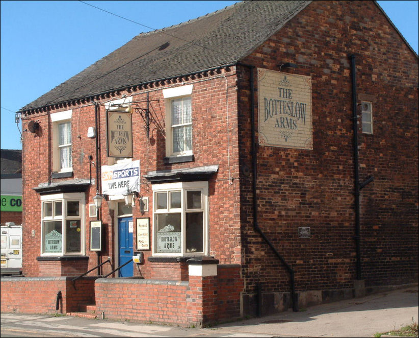
Botteslow
Arms on Leek Road
Botteslow Street and the Botteslow Arms were named after the district of
Botteslow
although they are on the very edge of the district
photo: Oct 2009
![]()
Evidence of the former mills on the River Trent in Botteslow...
Trentmill Road derives its name from the Upper Botteslow Mill, on the Trent, between at least 1759 and 1912, part of which (in 1960) was still standing at the end of Trentmill Road. Lower Botteslow Mill, a little way downstream was in use by 1792 and still in use in the early 1920's.
The trade directories often did not distinguish between the two Botteslow mills, one of which was a bone mill in 1834, but both were again flint mills by the 1860's
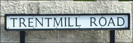
Trentmill Road
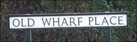
Old Wharf Road
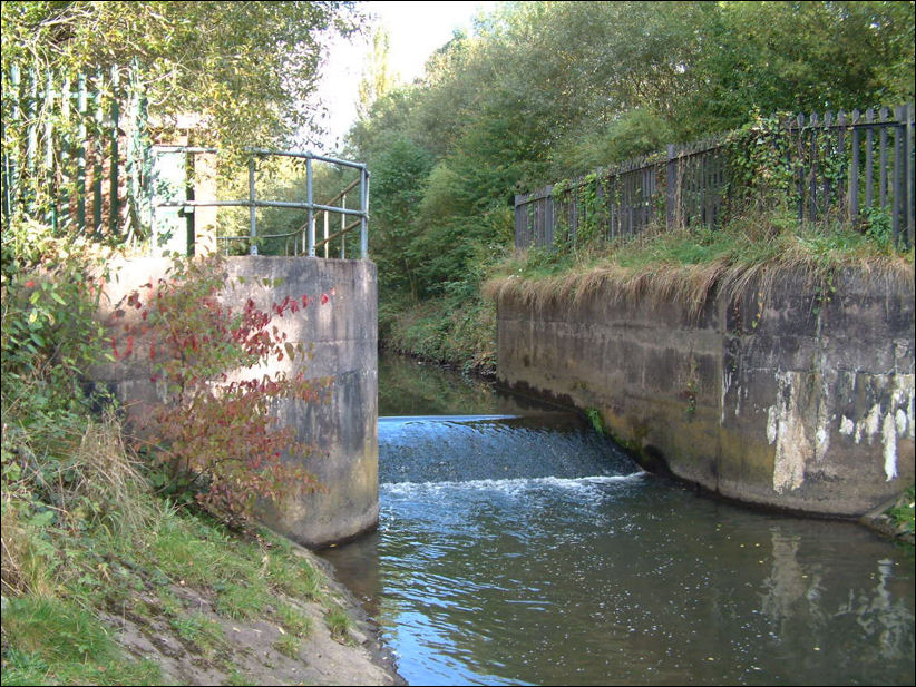
The weir of Upper Botteslow Mill on the River Trent at the bottom of Trentmill Road
![]()
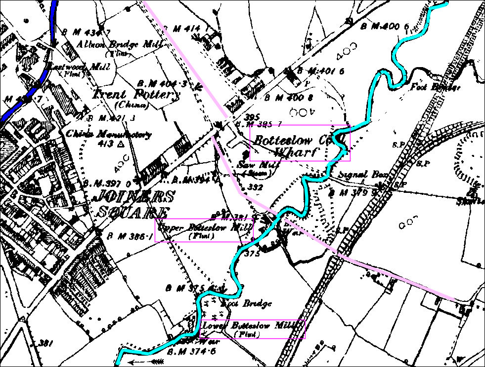
1890
map - the Caldon Canal in the top left, the River Trent in light blue, running
parallel with the Trent is the mineral railway
Leek Road runs through Joiners Square and in the bottom left is the junction
with Lichfield Street and Victoria Road
Botteslow Street and Trentmill Road
were not built at this time - their approximate location is shown in pink
|
The mineral railway from Stoke runs parallel to the River Trent past the Botteslow Mills and the north-eastern corner of the Township of Botteslow a single-track mineral line railway between Longton, Adderley Green, and Bucknall - it was opened by the North Staffordshire Railway Company in 1875. |
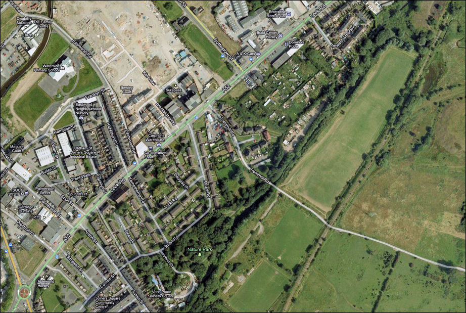
the
same area in 2011 - the Caldon Canal, River Trent, route of the former mineral
railway,
Leek Road, Botteslow Street and Trentmill Road can all be seen on this map
2011: Google Maps
![]()
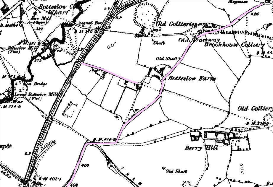
1890 map showing Botteslow Farm - the paths which later became Trentmill Road and Fenton Road are highlighted
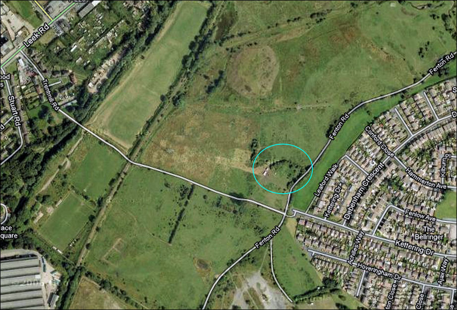
2011
map showing the location of Botteslow Farm on the edge of Eaton Park Housing
Estate
the farm was on the junction of Trentmill Road and Fenton Road
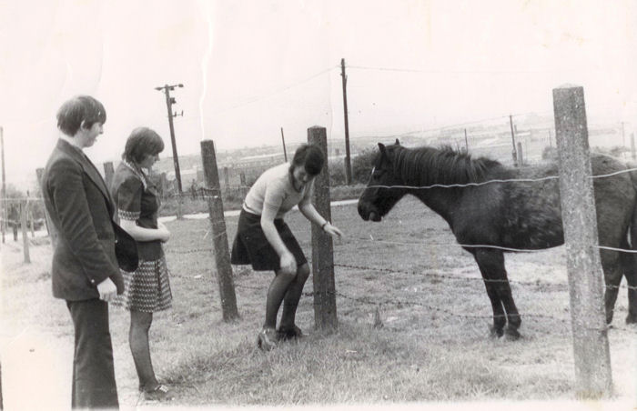
at
the bottom of Kettering Drive, horses on the fields of the former Botteslow Farm
in the background is Fenton Road
photo: c.1972
![]()
![]()
![]()
next: Northwood
|
related pages Botteslow Arms (to Sids Hairdressers) also see..
|