|
Church Lawton, Cheshire, (close
to Stoke-on-Trent)
|
Church Lawton
Church Lawton is a small village (sometimes
known as Lawton) located in the Borough of Congleton, Cheshire. Its
location is such that its eastern boundary forms part of the county
boundary between Cheshire and Staffordshire, and, because of its
close proximity to Stoke-on-Trent, the parish has a Stoke-on-Trent
postcode. The parish also contains the hamlet of Lawton Gate.
According to the 2001 census, the population of the entire parish
was 2,201.
- A township and parish in Northwich Hundred.
- Includes the hamlets of Hall Green (part), Lawton, Lawton
Gate, Lawton Heath, Lawton Springs, Little Moss (part), Moss Pit
and Red Bull.
- The population was 445 in 1801, 693 in 1851, 850 in 1901 and
971 in 1951.
The name Lawton itself is an indication of the parish's
ancient origin. The word has a Saxon meaning, namely "Farm by a
mound", and it is assumed that the mound is e hillock upon which the
present parish church (All Saints) stands, but whether or not the
mound was a barrow (an archaeological burial tumulus) is not known.
A dig on the field, some 3/4 mile away, between Crewe Road and
Knutsford Road has in recent years unearthed "Urns" of a prehistoric
period
In the early 18th century the post road from
London to Lichfield, Chester, Liverpool, and the North ran through
Newcastle to Talke-on-the-Hill and then crossed the Cheshire border
at Lawton. That part of the road between Tittensor and Talke had
become so ruinous that in 1714 a Turnpike Act for its repair and
maintenance was passed, and among the trustees were many Newcastle
burgesses, including the mayor. In 1735 the turnpike trust was
renewed for a further term of twenty-one years and the trustees
included the mayor, justices, and recorder of Newcastle. When
provision was made for further renewal in 1752, the town clerk was
added to the list of trustees. In this way Newcastle was strongly
represented on the managing body of the road.
Until 1763 the flint and clay used in china
manufacture, after being landed at Liverpool or Chester, was brought
in via Lawton and the turnpike road to Newcastle, whence it
proceeded by way of Wolstanton to Burslem and the other Pottery
towns. The manufacturers were obliged to use the same roundabout
route in the reverse direction for their finished goods. In that
year authority was obtained for the creation of a new road from
Lawton to Burslem
A History of the County of Stafford: Volume 8
(1963),
|
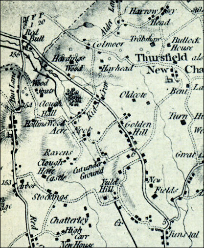
Extract from
William Yates 1775 Map of Staffordshire
at the top right hand corner is "Red Bull" which is over the
border in Cheshire
the major
road shown running from Tunstall to Red Bull is the 1762
turnpike road - now the A50
The Trent and Mersey
canal is the black line running from the bottom centre of the
map - where the canal goes through the Harecastle tunnel the
map states "cut under Ground" |

|

next:
background to the Church Lawton area |