| Districts | Streets | Maps |
next: views of the cemetery previous: introduction to the cemetery
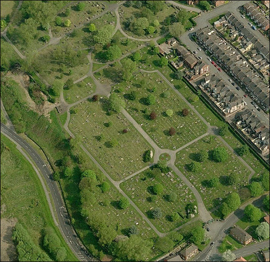
Tunstall Cemetery, Jacqueline Street, Tunstall
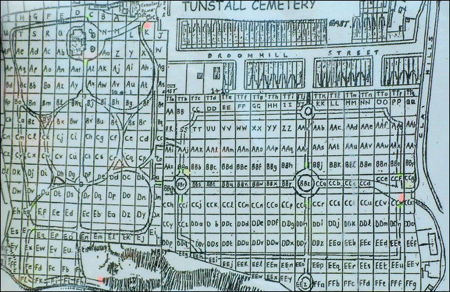
Maps of Tunstall Cemetery
Tunstall Cemetery - laid out on part of Tunstall farm bounded by Chatterley Road, Clay Hills and Broomhill Street
Layout of Tunstall Cemetery
The chapel which is shown at the top left of the layout map has been demolished, as have Fenton chapel and (Oct 2008) Burslem chapel.