Maps of Stoke-on-Trent & North Staffordshire
![]()
Maps of Stoke-on-Trent &
North Staffordshire
![]() | main
map index |
| main
map index |
Thomas Hargreaves map - Bradwell in 1832
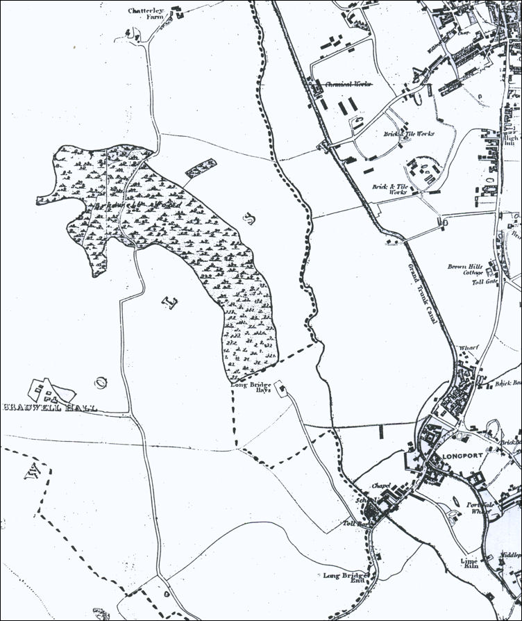
Thomas Hargreaves map - Bradwell in 1832
This map was published in 1832. It is an extract from Thomas Hargreaves' Map of the Staffordshire Potteries and Newcastle-under-Lyme.
Bradwell Hall was built on the top of a small hill at a height of just over 600 feet above sea level which gave the occupiers extensive views over the surrounding landscape. One of the most important features in that landscape was Bradwell Wood which occupied an area of about a hundred acres north east of the Hall.
The dotted line has been added to indicate the boundary of the the Sneyd estate which on the east side generally followed the line of the Fowlea Brook.
![]()
![]() | main
map index |
| main
map index |