Maps of Stoke-on-Trent & North Staffordshire
![]()
Maps of Stoke-on-Trent &
North Staffordshire
![]() | main
map index |
| main
map index |
Thomas Hargreaves map - Lane End and Longton in 1832
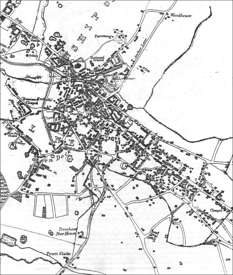
Thomas Hargreaves map - Lane End and
Longton in 1832
This map was published in 1832. Note that the top area is named "Lane End" and the bottom area named "Longton", the combination of the two areas into one and assuming the Longton name did not occur unit the early 1840's.
The hand drawn lines surrounding most of the built up area are the parish boundaries, most of the growth of the town had taken place within the boundaries of the parish of Stoke-upon-Trent.
Most of the land on the borders of the parish was the property of the Marquess of Stafford, later the Duke of Sutherland, of Trentham Hall.
![]()
![]() | main
map index |
| main
map index |