Maps of Stoke-on-Trent & North Staffordshire
![]()
Maps of Stoke-on-Trent &
North Staffordshire
![]() | main
map index |
| main
map index |
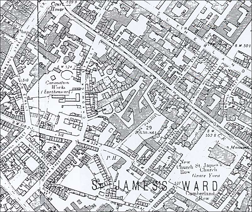
maps of Longton showing the Park Works & Park Place Works location
|
The
road running top left to the bottom of the right side is HIGH STREET
(Now Uttoxeter Road) In the
centre of the map are three potworks: The three streets running next to them are Chadwick Street, Park Passage (no longer in existence) and Albion Street (renamed Morpeth Street in the 1950's)
|

Looking down the High Street (now
Uttoxeter Road) towards Longton Town
On the left is the Albion Works
Then a gap which was the Park Works
Then the Roslyn and Gladstone Works which are the location of the Park Place
Works
Photo: July 2005

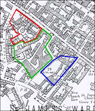
From an OS map c. 1900

Red:
Park Place Works
Green: Park Works
Blue: Albion Works
Park Place Works:
This site was split up into two smaller potbanks. This division of the property is still in evidence today: the Gladstone Pottery and the Park Place Works (now the Roslyn Works) , which lies adjacent to Gladstone, forms the other part of the original property.
Photo of works before restoration.
Photo of frontage of Gladstone & Roslyn works.
Photos of Gladstone works.
History of Gladstone.
Park Works:
Park works was under the ownership of Charles Allerton & Sons (1859-1942), these works have been demolished and form part of the car park for the Gladstone Museum.
Albion Works:
The Albion works are still in existence and three business's are in operation: Royal Winton Pottery, Ceramic Gas Products Ltd and Taylor Tunnicliff Ltd.
![]()
![]() | main
map index |
| main
map index |
updated 9 July 2005