![]()
Etruria: Etruria and Josiah
Wedgwood![]()
![]() (1760 onwards)
(1760 onwards)
The Round House of Wedgwood's factory
Location 3 on
the index map
The location of
the round house is shown on the
1877 Ordnance Survey map
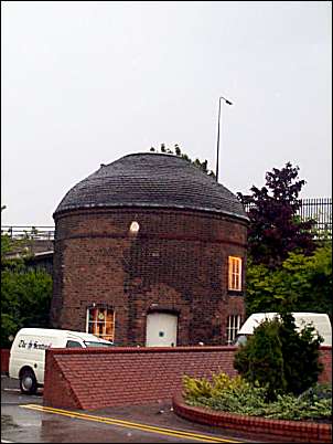
There
was a roundhouse at each end of the main façade.
The original use of these two buildings is unknown but
they may have been used as storerooms.
Production
on the site lasted until 1940 when the
earthenware department was transferred to the new factory at Barlaston.
The last of the factory buildings were demolished in the mid 1960s
and all that remains of the original works is the northern
“roundhouse” now part of the premises
occupied by the Sentinel newspaper.
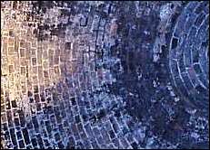
The inside roof of the
roundhouse
- built in the same manner as the traditional
bottle kiln.
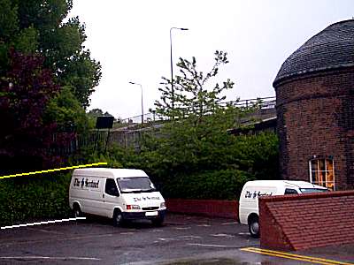
The white line on this picture
shows the current ground level
where the round house is.
The yellow line show the canal side level.
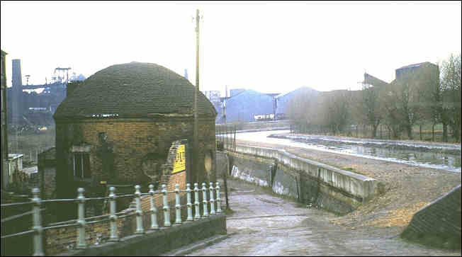
photo of the roundhouse which clearly shows the subsidence which has resulted
in the roundhouse being below the canal level
[in the background is the Shelton Steel Works]
photo: mid 1970's by Ken Cubley
look at the
pictures of the Wedgwood factory as built
and you will see that the canal & factory were on
the same level - the ground the factory sat on has
sunk about 8 feet (about 2.5 metres)
all the mining activity in the
area
was the cause of the subsidence
![]()
![]()
![]()
next is Wedgwood's factory
questions/comments/contributions? email: Steve Birks
