![]()
Hartshill Cemetery (reflecting the values of Victorian Society)
![]()
![]()
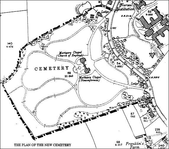
1898 Ordnance Survey Map of the cemetery layout
1898 Ordnance Survey Map of the cemetery layout
The extract from the 1898 Ordnance Survey map above shows the formal plan of the cemetery devised by Messrs Mimer and Son, landscape gardeners, of Crystal Palace, London. The dotted line added to the map shows the boundary of the site purchased from Mr Frederick Bishop on the Mount estate in 1882.
The cemetery was extended on the north side in 1904.
There was a lodge at each entrance to the cemetery from Queens Road - the southern lodge for the cemetery sexton, the northern lodge for the cemetery registrar.
![]()
questions/comments/contributions? email: Steve Birks