The Geography
of the Potteries (Stoke-on-Trent)
![]()
![]()
![]()
![]()
![]()
| Index - Subsidence in Stoke-on-Trent |
Subsidence of Wedgwood's Etruria factory
previous: photos showing works at canal level
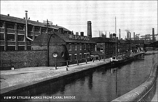
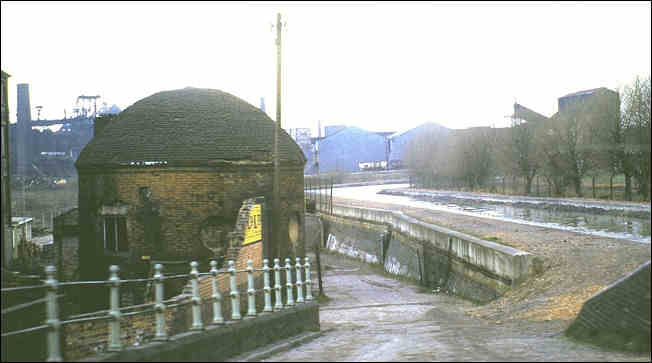
The following photo (around the late 1930's) should be compared with the pictures on the previous page - there is now a railing alongside the canal footpath and a slope down to the factory frontage. Compare the 'round house' between this and the previous pictures and it is obvious that the factory is suffering from severe subsidence.
Wedgwood Works, EtruriaTaken from the bridge on Etruria Road which runs from Hanley to Newcastle-under-Lyme.
The canal is the Trent and Mersey. In the back right of the picture can be seen the
Shelton Iron and Steel works.
photo of the roundhouse which clearly shows the subsidence which has resulted
in the roundhouse being below the canal level[in the background is the Shelton Steel Works]
photo: mid 1970's by Ken Cubley
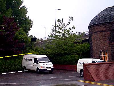
The 'round house' in 2000
(which is all that is left of Wedgwood's factory)
The white line on this picture shows the current ground level
where the round house is.The yellow line show the canal side level.
look at the pictures of the Wedgwood factory as built
and you will see that the canal & factory were on
the same level - the ground the factory sat on has
sunk about 8 feet (about 2.5 metres)all the mining activity in the area
was the cause of the subsidence
![]()
![]()
previous:
photos showing works at canal level
![]()
![]()
questions/comments/contributions? email: Steve Birks
![]()
![]()
![]()