|
Cobridge School:
Sneyd Street appears
on the 1775 William Yates map of Staffordshire.
In
the 1680s there were only three or four small houses at Cobridge but
by the mid 1770s a distinct settlement had come into existence in
the vicinity of the cross road formed by Sneyd Street, Grange Street
and Elder Road.
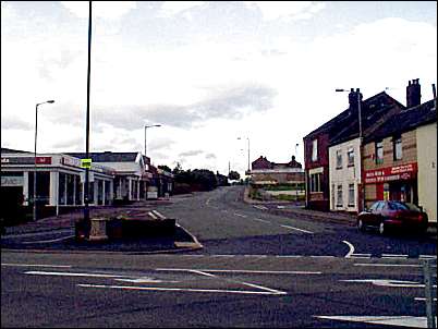
View up Sneyd Street
from Elder Road
By
1766 the population of the district had increased to the point where
provision was made for the construction of a school to serve the
area.
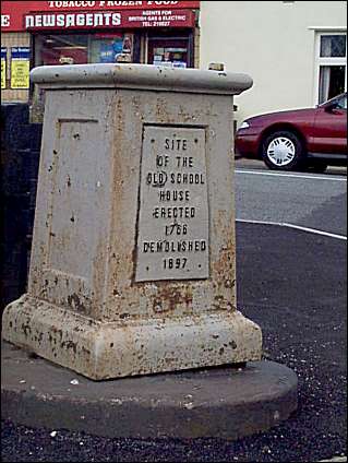
Site of the Old
School House,
Erected 1766 Demolished 1897.
The
original trust deed for the school was made between Thomas Fenton of
Newcastle Gent. and 57 trustees including Josiah Wedgwood and John
Hales devised:
“a piece of land in Cobridge containing 120 sq
yards lying on the north side of the road leading from Cobridge to
Burslem & a dwelling house & other buildings erected upon it for the
purpose of a school for the education and instruction of children, &
a Public hall for the purpose of meetings for transacting public
affairs in Cobridge & its neighbourhood".
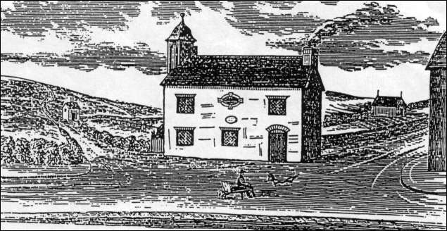
Cobridge School
- the front of which faced Elder Road
Sneyd Street is the road on the right.
(from Scarratt: "Old times in the Potteries" 1906)

|