Streets of Stoke-on-Trent | Glebe Street |
Glebe Street, Stoke,
Stoke-on-Trent
![]()
Streets of Stoke-on-Trent | Glebe
Street |
![]()
![]()
| Index of all Stoke Streets |
Glebe Street, Stoke, Stoke-on-Trent
1898 Ordnance Survey map of Glebe Street area
Residents and Proprietors of Glebe Street
Map of the Glebe Land belonging to Stoke Church
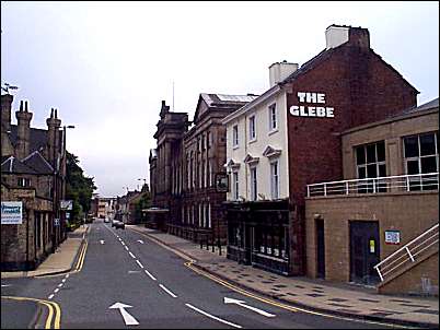
Glebe Street in the town centre of Stoke is only a few hundred yards long but contains 14 'listed buildings' (although some are not buildings but tombstones in the church yard) and Brook Street, which runs off Glebe Street contained 5 'listed buildings'.
Glebe Street runs from Church Street (the old turnpike road) at the bottom to the Trent and Mersey Canal and mainline railway at the top. The top end of Glebe Street also crosses the A500 dual carriageway which joins many of the Potteries towns to the M6 motorway. The A500 runs parallel to the Trent and Mersey Canal at this point.
Next: start the tour of Glebe Street
|
|
![]()
Next: start the tour of Glebe Street
Why the name - Glebe Street?
In the past, parishes were maintained out of the land attached to the church (the glebe) and the revenues from the faithful.... Rectors were not salaried, but held property in the parish as their "living".
1898 Ordnance Survey map of Glebe Street area
Residents and Proprietors of Glebe Street
Map of the Glebe Land belonging to Stoke Church
list of photographs of Glebe Street
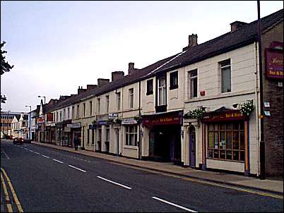
General view of Glebe Street in 2000 and 1915 (looking from Church Street).
Next: start the tour of Glebe Street
![]()
![]()
![]()
Did you live in this street or
area?
questions/comments/contributions?
email: Steve Birks