|
The route of
Boathorse Road:
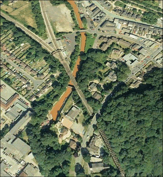
The Trent and Mersey canal as it emerges
from the north end of the Harecastle tunnel
this is Kidsgrove near the A50 Liverpool Road
-so named 'Liverpool Road' as it was the
export road from the Potteries to the ports at Liverpool docks -
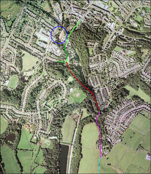
The blue circle is the north end of
the Harecastle tunnel - over the years sections of Boathorse Road
has been merged into other roads....
green line = "The Avenue"
red line = "Boathorse Road"
purple line = "Nelson Bank"
light blue line = "Acres Nook Road"
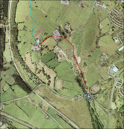
The blue circle is the south end of
the Harecastle tunnel - over the years sections of Boathorse Road
has been merged into other roads....
light blue line = "Acres Nook Road"
red line = "Boathorse Road"
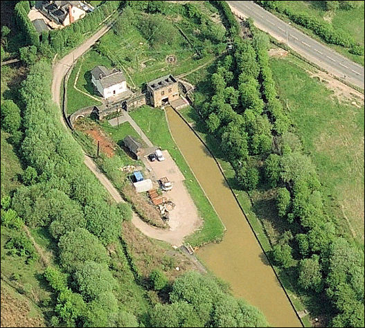
The Trent and Mersey canal as it
enters
the south end of the Harecastle tunnel
this is near Tunstall and the other end of the A50 / A527 road.

|