|
|
| Stoke-on-Trent Districts: Hanley to Burslem |
![]()
next:
Century Street
The Road from
Hanley to Burslem via Cobridge
|
In the Victorian era, Cobridge transformed from a collection of rural farmsteads into a bustling, soot-covered industrial suburb. Situated on the "ridge" between Hanley and Burslem, it became a landscape of extreme social contrasts, where grand residences for wealthy pottery owners sat just streets away from cramped workers' terraces. The Rise of the "Victorian Suburb"
Key Manufacturers: Major 19th-century works included:
|
|
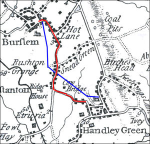
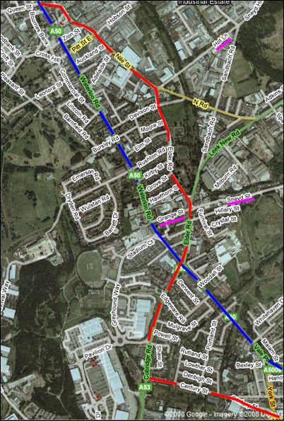
Compare the two maps, the red line shows the meandering road from Hanley to Burslem - along the present day Century Street, Cobridge Road, Elder Road and Nile Street. The blue line shows the direct route of Waterloo Road which was not complete until 1817 As location points see Hot Lane (present on both maps), Sneyd Street (Snead Green on the 1775 map) and Grange Street on the 2008 map - which is the track shown on the 1775 - leading to Rushton Grange.
|
|
![]()
next:
Century Street
30 January 2008