A landmark in the regeneration of the Potteries
![]()
| The National Garden Festival, Stoke-on-Trent (1986) A landmark in the regeneration of the Potteries |
|
| Index | Etruria Valley 250 years of change | Fact & Figures | Sculptures | Photographs | Related pages |
The Etruria Valley: Rural Origins, Industrial Growth and Garden Festival
The National Garden Festival, Stoke-on-Trent (1986)
|
Maps and photographs chart the evolution of the Etruria Valley from Wedgwood’s early works through industrial expansion to the Garden Festival and Festival Park.
|
click on the thumbnail maps to explore the
development of the area in more detail
- look for the canal and Etruria Hall — visible in every map despite over 250 years of change -
 |
 |
 |
| c.1766–1777 – The Ridge House Estate The origins of industrial Etruria |
1832 – Etruria in a Rural Setting Industry within the countryside |
Before 1840 – A Rural Valley Etruria before large-scale industry |
|
This map shows the estate acquired by Josiah Wedgwood, where his pottery works were established in 1769. The Trent & Mersey Canal already planned, was completed by 1777. |
Hargreaves’ 1832 map shows the Etruria Pottery Works and Etruria Hall set within open countryside, before the arrival of large-scale iron production. |
An early engraving depicts the valley as a pastoral landscape of fields and trees, with the Wedgwood works and Etruria Hall set within a largely unspoilt setting. |
 |
 |
 |
 |
| 1879 – Early Industrial Development A landscape beginning to change |
1926 – Industry Expands Factories, railways, and growth |
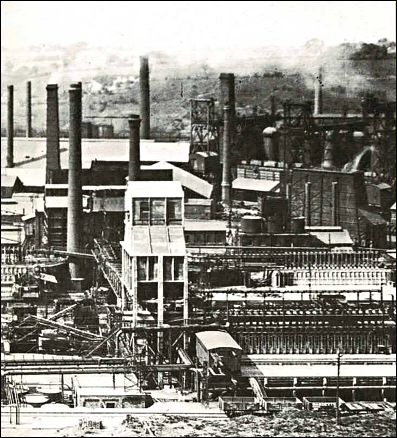
1941 – Industrial Peak The height of heavy industry |
c.1950 – Industrial
Impact A landscape shaped by heavy industry |
| Shows the early growth of the Etruria ironworks, with industry starting to dominate the green land area alongside the Trent & Mersey Canal and the still-prominent Etruria Hall. | Photographs from the Shelton area show an increasingly industrial landscape, with railway tracks, kilns, and chimneys dominating the valley as production expands. | The site is almost entirely occupied by iron and steel works, with dense building coverage and extensive rail sidings reflecting the height of industrial activity. | The Shelton Steel Works dominates the scene, surrounded by slag heaps and spoil. The Trent & Mersey Canal and the Potteries Loop Line run through the industrial terrain. |
 |
 |
 |
| 1985 – Preparing for the Festival From dereliction to renewal |
1986 – Garden Festival Site A transformed landscape |
c.2020 – Festival Park Today Legacy of regeneration |
|
An aerial view taken just six months before the opening of the National Garden Festival shows the site in transition. The canal and new marina are visible, with the remaining parts of the former steelworks. |
The Festival map reveals the dramatic change from industry to parkland, with gardens, lakes, and visitor attractions replacing the former steelworks. |
A modern view of the site shows retail, leisure, and open space, still shaped by the layout created for the 1986 Festival, with the canal and historic features remaining. |
|
|
|
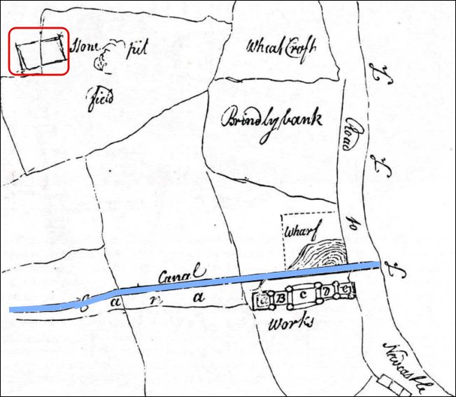
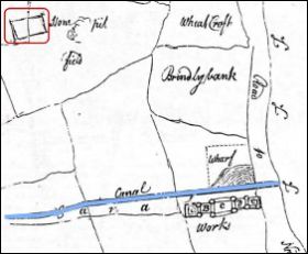
map showing part of the Ridge
House Estate bought by Josiah Wedgwood
from a Mrs Ashenhurst for £3000 in 1767
|
"The line of the new Trent and Mersey Canal has been drawn across the existing fields. Below this the new factory is shown arranged around a series of courtyards next to the turnpike road to Newcastle-under-Lyme. On the other side of canal in Stone pit field is the site of Etruria Hall" Andrew Dobraszczyc, Social History Walks -Josiah Wedgwood & Etruria. |
![]()
|
|
|

extract from Hargreaves’ 1832 map shows the Etruria Pottery Works and Etruria Hall
![]()
|
|
|
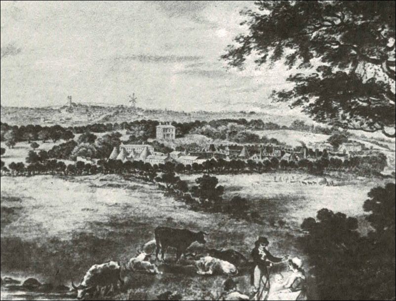
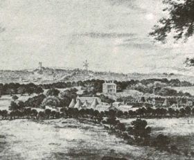
engraving depicting the
Etruria Valley prior to 1840
from - 150 years of the Shelton Works
![]()
|
|
|

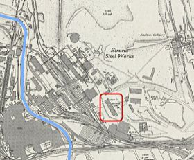
1879 map of the area which was
reclaimed for the 1986 Stoke-on-Trent National Garden Festival
|
This Ordnance Survey map, published in 1879, has been orientated to fit in with the National Garden Festival map shown below. The Trent and Mersey Canal runs across the top of both maps.
|
![]()
|
|
|
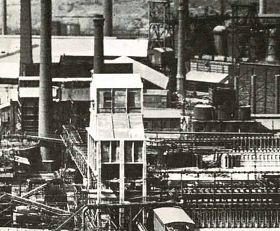
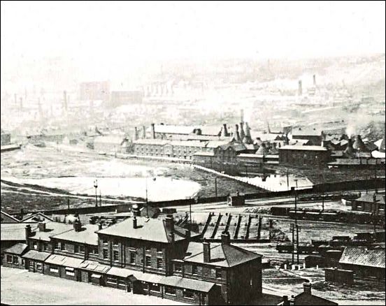 In the middle ground on the other side of the canal is the Wedgwood pottery works. In the foreground is Etruria Hall then used as the offices for the iron & steelworks. |
 The coking plant and blast furnaces - the three furnaces were capable of making 6,000 tons of iron a week |
views of the works in 1926
from - 150 years of the Shelton Works
![]()
|
|
|
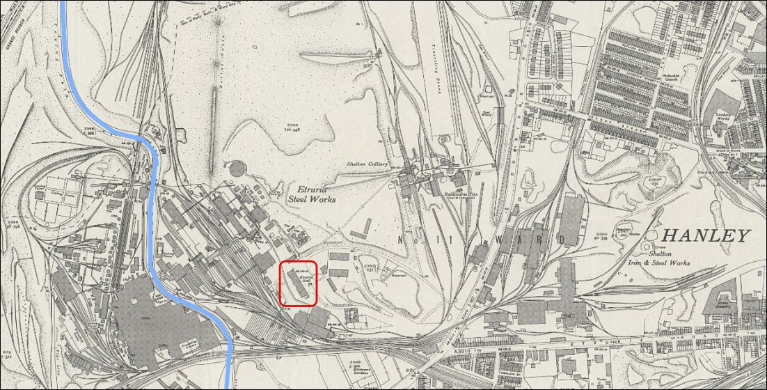
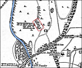
1941 map showing how the steel
works had greatly expanded.
Red rectangle - Etruria Hall (former Wedgwood home)
![]()
|
|
|
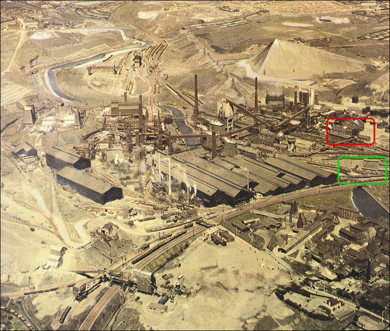
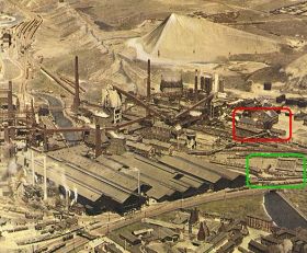
Aerial photograph of the works
c. 1950
red rectangle is Etruria Hall and green
rectangle is the general location that the marina would be built
from - 150 years of the Shelton Works
![]()
|
|
|

aerial view taken
six months before the opening of the National Garden Festival
red rectangle is Etruria Hall and
at the bottom left of the photograph is the marina
![]()
|
|
|
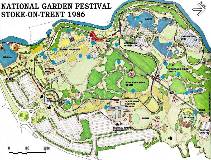
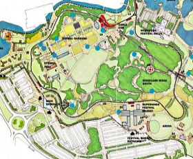
this map is from the Official Guidebook of the Festival
![]()
|
|
|
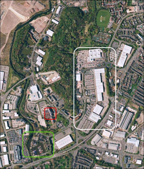
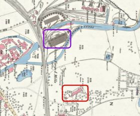
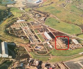
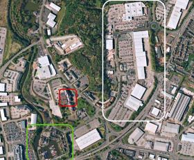
Bing maps c.2020
Red rectangle - Etruria Hall (former Wedgwood home) now part of a hotel complex
Green rectangle - Marina, can be seen on the Festival map
White rectangle - the Festival Retail Park
The Trent & Mersey canal runs to the left
The South Woodland Ridge can be seen in the centre of the map
![]()
|
|
|
Last updated: 5 May 2026 - section completely updated. |