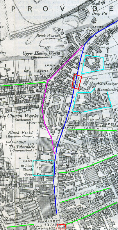
| Old
Town Road, Hanley
High Street, Hanley ran
from Market Square, past St. John's Church, to Providence Square at
what was Upper Hanley at the top end of Northwood Road.
In the early 1950's
High Street was renamed Town Road (this was because there were about
12 "High Streets" in the Potteries).
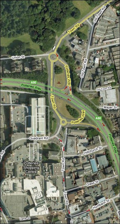
In 1986 the
development of the A50 "Potteries Way" cut across a number of the
adjacent streets.
The part of Town Road near Hanley Deep Pit colliery
was moved to provide feeders to the Potteries Way and the top part of
Town Road was renamed to "Old Town Road"
At the end of
the 1960s the whole area of the brick works, Hanley Deep Pit and
Shelton Colliery was a bleak, empty wasteland but by 1971 the £300,000
reclamation scheme was completed. Most of the regenerationarea was the land and
the spoilheaps of the Hanley Deep Pit which closed in 1967, which at
its peak employed 1300 men.
The following pages
follow the feature of the High Street, with a special look at "Old
Town Road"
|