|
Normacot Road, Longton
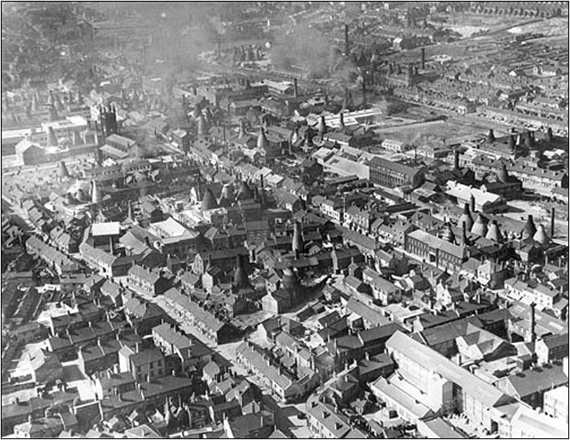
Longton in the 1930-40's
photo from the Lovatt collection
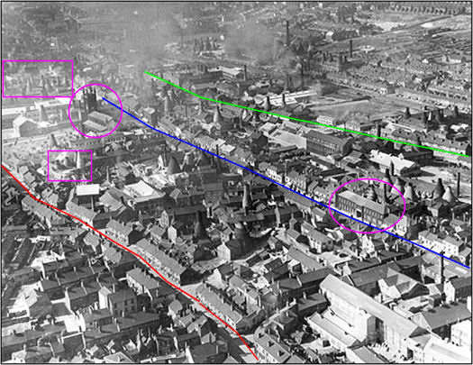
green line = Sutherland
Road
blue line = Uttoxeter Road
red line = Normacot Road
landmarks still present today.......
top left purple rectangle = Gladstone & Roslyn works
(now Gladstone Museum)
top left circle = St. James church
lower left rectangle = Enson Works and Short Street
right circle = Tams Blythe Works on Uttoxeter Road
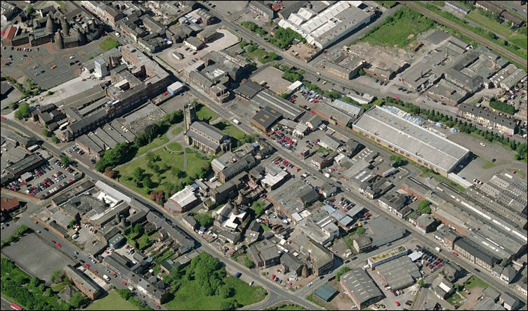
Same scene Feb 2008 photo from Live Search
the landmarks in the main picture can all be seen in this photo
  
next: Longton
Spiritualist Church
previous: Maps of Normacot Road
|