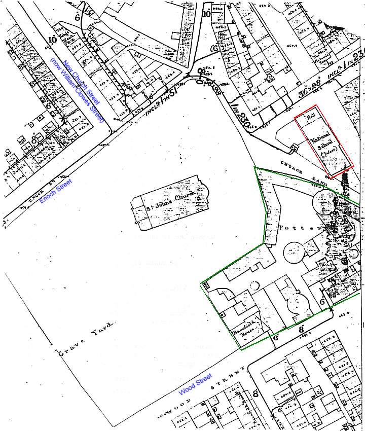
 1851 Ordnance Survey map of St. John's Church, Burslem
The extract from
the Ordnance Survey map shows St John's church and its vicinity in 1851. By
then the church yard had been extended twice in 1804 and 1847 (compare this
map with the map of 1740).
The Churchyard
Works was situated south east of the church.
Above the works
was Burslem National School a three-story structure erected in 1817 at a cost
of £2000. It was built to accommodate 600 children but was half empty in 1840
because most parents preferred to send their children to the Methodist schools
and to Burslem Sunday School.
The street on the
north west side of the church was New Church Street (now William Clowes
Street) built in the late 18th century to improve the connection between the
parish church and the town centre. Previously church attendees had to go via
Church Street (renamed Old Church Street, and now called Bournes Bank) which
was longer, winding and dirty.
The key role
played by Enoch Wood in the improvement of the church and its vicinity is
reflected by the fact that the two streets bordering the church yard were
called Enoch St. and Wood St.
Enoch Street still
exists today - Wood Street has been renamed 'Anna Walk' and 'Card Street' -
after Arnold Bennett's books.

1851 Ordnance
Survey Map
Burslem National
School shown in red, erected in 1817 at a cost of £2000
Church Yard Works in green on the South East side of the Church.
![]()
![]() (1714-1837)
(1714-1837)