![]()
Longport: The 'Kingdom' of
Davenport![]()
![]() (1760's - mid 19th C))
(1760's - mid 19th C))
The maps are 80-130k in size and so will take
few minutes to download, but they are worth the
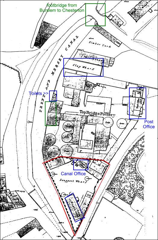
wait if you are interested the history of Longport.1851 Ordnance Survey Map showing the Top Bridge Pottery and Longport Wharf.
1851 Ordnance Survey Map showing the Top Bridge Pottery and Longport Wharf.
Interestingly the position of the toilets, marked on this map is recorded by Moses Lees, the superintendent of the Top Bridge Pottery during his report to Scriven's (on Child Labour in 1841)
'We are well supplied with drains, which empty themselves into the canal at the back of the works. Our privies for the people are private, and separated for the sexes by a wall, the doors being opposed to each other. On no consideration do they interfere with each other; if they did I have no doubt that the parties would be discharged.'
![]()
questions/comments/contributions? email: Steve Birks