| Stoke-on-Trent Districts: Sytch |
![]() 1895 map showing location of The Sytch
1895 map showing location of The Sytch
![]() 1832 map showing location of
Sytch Hollow & Burslem Mill
1832 map showing location of
Sytch Hollow & Burslem Mill
![]() 1800 map showing location of
Hill Top, the Sytch & Sytch Brook
1800 map showing location of
Hill Top, the Sytch & Sytch Brook
![]() 1750 map showing location of
Hill Top, the Sytch & Sytch Brook
1750 map showing location of
Hill Top, the Sytch & Sytch Brook
![]()
![]()
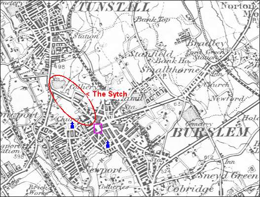
1895 map showing location of The Sytch
1895 map showing location of
The Sytch
Sytch - a small area centred on Westport Road (was called Liverpool
Road), Burslem.
Westport Road is a steep road running from Burslem down to Brownhills.
Bottom Church = St. John's
![]()
Church to the left = St. Paul's
![]()
Square = St. John's
Square
![]()
![]()
1832 map showing location of Sytch Hollow & Burslem Mill
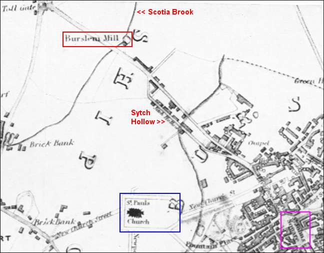
From a map of 1832
by T. Hargreaves showing location of Sytch Hollow
Burslem Mill located on Scotia Brook and just to the east of Liverpool
Road was also called "Sytch Mill"
and Scotia Brook was also known as "Sytch Brook"
NOTE: on this map the spelling is "Sitch Hollow"
Church, bottom centre = St. Paul's
![]()
Square, bottom left =
St. John's Square
![]()
![]()
1800 map showing location of Hill Top, the Sytch & Sytch Brook
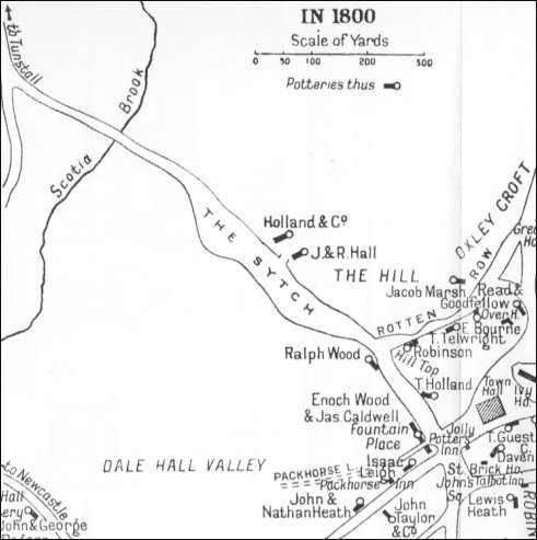
1800 map showing location of
The Sytch & Scotia (Sytch) Brook
![]()
1750 map showing location of Hill Top, the Sytch & Sytch Brook
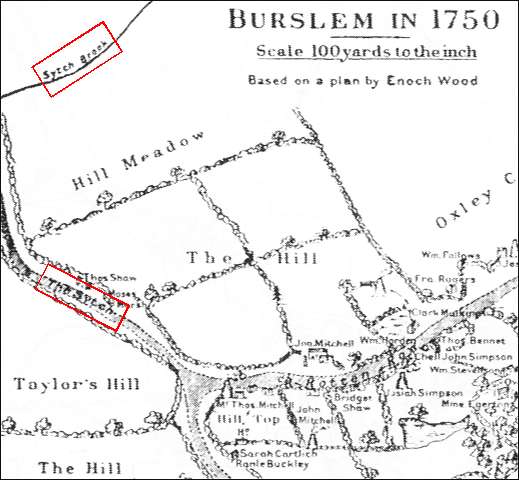
1750 map showing location of
The Sytch & Sytch Brook
![]()
![]()
![]()
more on Sytch
questions / comments / contributions? email: Steve Birks
8 January 2006