Abbey
Hulton
Historic district of Stoke-on-Trent centred on Hulton Abbey and the Caldon Canal
|
Abbey
Hulton is a district on the north-eastern side of Stoke-on-Trent,
taking its name from the medieval Cistercian Hulton Abbey founded
in 1223. For centuries the area remained largely rural farmland
and woodland, crossed by ancient routes linking Hanley, Sneyd
Green, Milton and Leek. |
|
| Abbey
Hulton at a glance |
| Historic
parish |
Formerly part of the parish of Burslem, often known as the lordship of Hulton. |
| County
borough |
Became part of the County Borough of Stoke-on-Trent in 1922 |
| Main roads |
Leek Road, Birches Head Road |
| Expansion
period |
The area saw significant housing development in the 1920s and 1930s, partly for re-housing residents from slum clearances in other parts of the city. |
| Waterways |
Caldon Canal,
River Trent |
| Railway |
Biddulph Valley
Branch mineral railway |
| Industries |
Farming, mining |
| Landmark |
Remains of
Hulton Abbey |
|
Name
origin
The name Abbey Hulton first appeared in its modern combined form by the late 16th century, historically recorded then as "Abbey Hilton"
The name combines two historic elements. “Hulton” was recorded in the Domesday Book of 1086 as “Heltone”, derived from the Old English hyll and tūn, meaning “hill settlement” or “hill town”.
The “Abbey” prefix refers to the Cistercian Abbey of St. Mary at Hulton, founded in 1223 by Henry de
Audley. |
Explore within this page...
Explore related
pages...
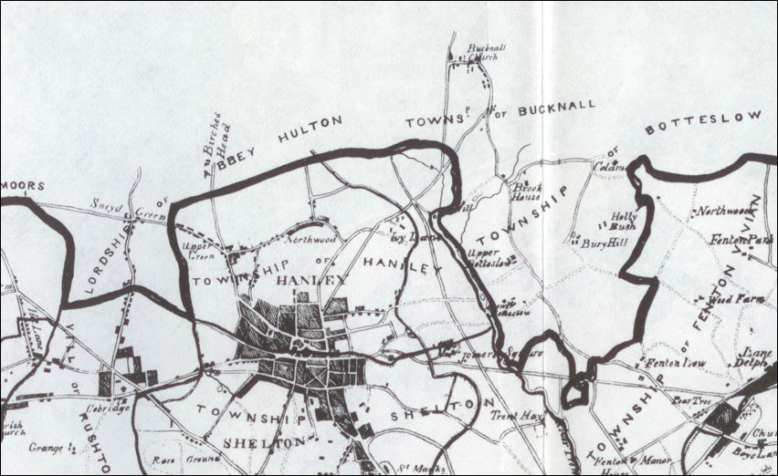
The Lordship of Abbey Hulton
situated to the north-west of the Borough of Stoke-upon-Trent
|
The historic Lordship of Hulton lay within the ancient parish of Burslem and included Sneyd Green, Birches Head and parts of Milton.
-
Recorded in the Domesday Book of 1086, the area was granted to the Abbey of St Mary in 1223 and remained largely rural for centuries.
-
Although the population gradually increased during the nineteenth century, major development did not take place until the twentieth century.
-
Abbey Hulton officially became part of the County Borough of Stoke-on-Trent in 1922.
Map source: Ward, John. The Borough of Stoke-upon-Trent. London: W. Lewis & Son, 1843. |

|
Origins of Abbey Hulton
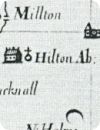
Abbey Hulton takes its name from the former Hulton Abbey, situated about half a mile from Milton on the eastern side of the historic road from Stoke to Leek. The name “Hulton” was recorded in the Domesday Book of 1086 as “Heltone”, derived from the Old English hyll and tūn, meaning “hill settlement” or “hill town”.
-
Historically, the lordship of Hulton lay within the ancient parish of Burslem and included Sneyd Green, Birches Head and parts of Milton.
-
The district was defined by natural features including Woodhead Farm, Hot Lane Brook, sections of the River Trent and the Foxley Brook.
-
Although the medieval lordship was often referred to as “Abbey Hulton” from the late sixteenth century onwards, the modern suburban district lies mainly to the south of the original manor boundaries.
-
In the hearth tax returns of 1666, only 30 houses were listed — a striking contrast to the modern suburban district of today.
-
The population of Hulton rose steadily during the nineteenth century, increasing from 477 inhabitants in 1821 to 945 by 1871. Even in the late 1870s development remained limited mainly to Sneyd Green and the Milton area near the road to Bagnall.
|
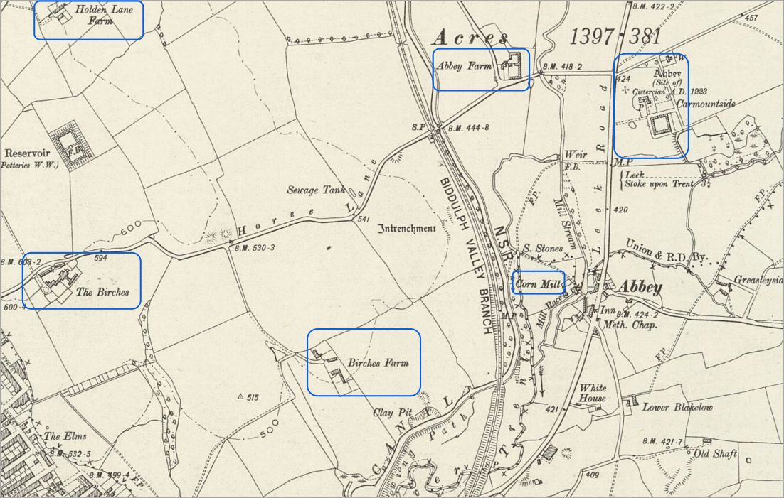
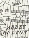
1900 OS map of Abbey
Staffordshire
XII.14; National
Library of Scotland
|
By the late sixteenth century the historic lordship of Hulton was often known as “Abbey Hulton”, although the modern district extends mainly south of the original manor boundary.
-
The area developed around a network of historic roads linking Stoke, Hanley, Leek and the surrounding villages, many of which are shown on this 1900 Ordnance Survey map.
-
The road now known as Birches Head Road was originally marked as Horse Lane between The Birches and Abbey Farm, only adopting its modern name in the mid-twentieth century.
-
The Caldon Canal, opened in 1779, passes through the district and was later joined by the Biddulph Valley railway line in 1864, both of which played an important role in the area’s industrial and residential development.
|
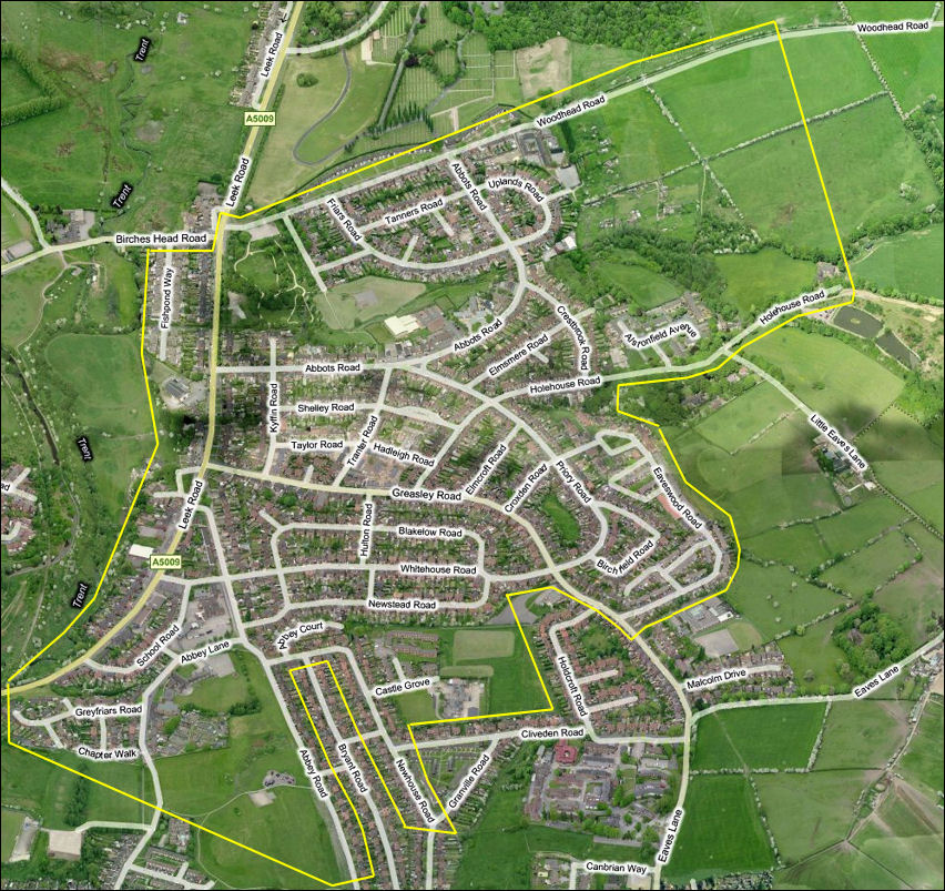
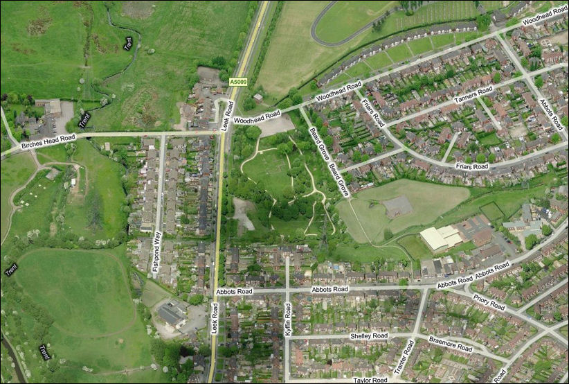
Extent
of Abbey Hulton, Stoke-on-Trent - the River Trent on the left
the site of the Cistercian Abbey
is marked in red
Bing maps - 2012
|
Hulton
Abbey
The Abbey of St Mary at Hulton was founded in 1223 by Henry de Audley for the Cistercian order, commonly known as the White Monks. As with many Cistercian houses, the abbey was established in a relatively remote and undeveloped rural location.
-
Throughout the Middle Ages the Audley family continued to support the monastery, although Hulton Abbey remained one of the poorest monastic houses in Staffordshire and never housed more than a small community of monks.
-
The monks followed the typical Cistercian pattern of agriculture and land management. Sheep farming formed an important part of the abbey economy, with sheepfolds recorded at Normacot and Mixon during the thirteenth century. The abbey also operated granges at Hulton and Rushton near Burslem. Other activities included tanning, milling and the production of encaustic tiles and pottery during the medieval period.
-
Among the abbey’s most notable burials was Sir James de Audley, celebrated for his bravery fighting alongside the Black Prince at the Battle of Poitiers in 1356. He and his wife were buried before the high altar in the abbey church choir. A local tradition later claimed that when the tombs were opened during demolition of the church, the lady’s hair had continued to grow
luxuriantly!
-
The abbey was surrendered to the Crown on 18 September 1538 during the Dissolution of the Monasteries. At the time it was valued at only £200 per year and housed just nine monks including the abbot.
-
In 1543 the abbey site and manor were granted to Sir Edward Aston of Tixall. Ownership later passed to the Sneyd family of Keele in the early seventeenth century, and much of the surrounding land remained in Sneyd ownership for centuries afterwards.
-
Excavations of the abbey ruins took place in 1884 and again during the early 1930s. Stone recovered from the abbey buildings was reused locally, including in nearby Abbey Farm and other buildings in the district.
|
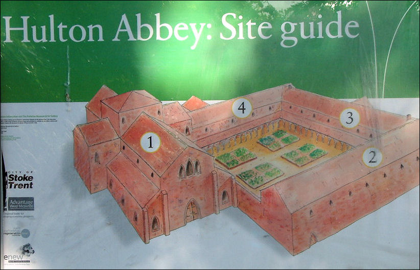
Hulton Abbey
: Site Guide
|
Hulton Abbey
1219 - 1538
|
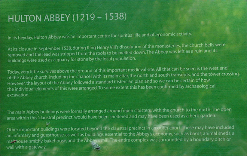
HULTON ABBEY (1219 –
1538)
In its heyday, Hulton Abbey was an important centre for spiritual life and of economic
activity.
At its closure in September 1538, during King Henry VIII’s dissolution of the monasteries, the church bells were removed and the lead was stripped from the roofs to be melted down. The Abbey was left as a ruin and its buildings were used as a quarry for stone by the local
population.
Today, very little survives above the ground of this important medieval site. All that can be seen is the west end of the Abbey church, including the chancel with its main altar, the north and south transepts, and the tower crossing. However, the layout of the Abbey followed a standard Cistercian plan and so we can be certain of how the individual elements of this were arranged. To some extent this has been confirmed by archaeological
excavation.
The main Abbey buildings were formally arranged around open cloisters, with the church to the north. The open area within this ‘claustral precinct’ would have been sheltered and may have been used as a herb
garden.
Other important buildings were located beyond the claustral precinct in an outer court. These may have included an infirmary and guesthouse, as well as buildings essential to the Abbey’s economy, such as barns, animal sheds, a malthouse, smithy, bakehouse, and the Abbey’s mill. The entire complex was surrounded by a boundary ditch or wall with a gateway. |
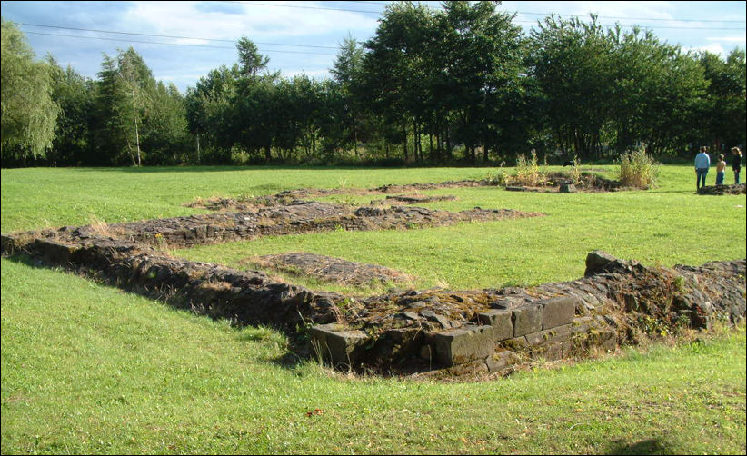
the remains of the walls
of the west end of the Abbey Church
photo: 2012
|
The Abbey of St Mary at Hulton belonged to the Cistercian order, commonly known as the White Monks. Founded in 1223 by Henry de Audley, it was established in what was then a remote rural part of Staffordshire, typical of the isolated locations favoured by the Cistercians for their monasteries.
The Audley family remained important benefactors throughout the Middle Ages, although Hulton Abbey was always one of the poorer monastic houses in the county and supported only a small community of monks.
The remains visible today include parts of the abbey church, including the west end, chancel and main altar area, together with the north and south transepts and the central tower crossing. |
the site of the Cistercian
Abbey
Bing maps - 2012

the extent of the
remains of the walls of the Abbey
buildings
Bing maps - 2012
Excavations of
the abbey site took place in 1884 and again in the early 1930s.
Stone
from the abbey complex was used in a number of buildings in the
vicinity, including Abbey Farm.
|
Agriculture, Industry and Early Pottery
The monks of Hulton Abbey were active not only in agriculture but also in local industry. A tannery existed at Hulton by the late thirteenth century, while a fulling mill probably operated on the River Trent in connection with sheep farming and cloth production.
-
The abbey also maintained fisheries and fishponds near the river, traces of which still survive today near Fishpond Way.
-
Medieval tile-making and pottery production formed another important activity. Historical sources suggest that monks at Hulton Abbey were involved in the manufacture of encaustic floor tiles and fine pottery from the fourteenth to the sixteenth centuries.
-
After the dissolution of the abbey in 1538, members of the Adams family continued pottery production at the former monastic site for many years.
-
The district also possessed valuable mineral resources. Coal mining was already taking place at Lee Field by the time of the Dissolution, when a mine formerly worked by the monks was leased by the Crown to Thomas Foxe.
-
By the mid-seventeenth century the Adams family of Birches Head were operating coal mines within the manor, and mining continued under the Sneyd estate into the eighteenth and nineteenth centuries.
-
The area may also have derived the name “Carmountside” from deposits of iron-bearing clay known locally as “car”, which accumulated from spring water passing through clay ironstone strata.
|
|
Roads, Canal and Railway
Abbey Hulton developed around a network of ancient roads and later transport routes which linked the district to the wider Potteries area. Leek Road, running from Stoke towards Endon, had been established by 1842 and became one of the principal routes through the district. Another ancient route connected Great Chell to Hanley through Sneyd Green and High Lane; this road was turnpiked in 1770.
-
Additional routes included Birches Head Road crossing the River Trent near Abbey Farm, and the road formed by Sneyd Street, Milton Road and Foxley Lane, which once carried traffic from Newcastle-under-Lyme towards Leek. Part of this route may originally have served as a pathway linking Hulton Abbey with its grange at Rushton near Cobridge.
-
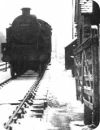
The Caldon Canal, opened in 1779 between Etruria and Froghall, passes directly through Abbey Hulton and played an important role in the industrial growth of the area.
-
Running alongside the canal was the Biddulph Valley railway line, opened in 1864, which further improved communications and industrial transport.
-
A bridge known as Abbey Bridge existed by 1733 and is believed to have stood on the site of the present bridge carrying Birches Head Road over the River Trent near Abbey Farm.
|
|
The
River Trent, Mills and Fishponds
The River Trent played an important role in the development of Abbey Hulton and the medieval abbey estate.
-
A 1900 Ordnance Survey map shows the river flowing close to the abbey site, together with a complex arrangement of channels, loops and water-management features including a weir, mill stream and mill race. These controlled the flow of water to serve the abbey’s mills and surrounding farmland.
-
A corn mill stood beside the river for many centuries, demonstrating the importance of water power to the local economy. During the Middle Ages the monks of Hulton Abbey are also believed to have operated a fulling mill on the Trent in connection with sheep farming and cloth production, activities commonly associated with Cistercian monasteries.
-
A sketch of “Abbey Hulton Mill”, reproduced in Ten Generations of a Potting Family, provides a rare glimpse of one of the later mill buildings associated with the site.
-
The abbey’s endowment included fishing rights, almost certainly centred on the Trent itself. Fish formed an important part of the monastic diet, particularly during periods of religious fasting, and the monks maintained fishponds close to the river. Traces of these medieval ponds remain visible today on the opposite side of the main road from the abbey ruins, while the modern name
-
Fishpond Way preserves the memory of this earlier landscape.
Today the River Trent still follows much of its historic course through Abbey Hulton, linking the modern suburban district with its medieval past.
|
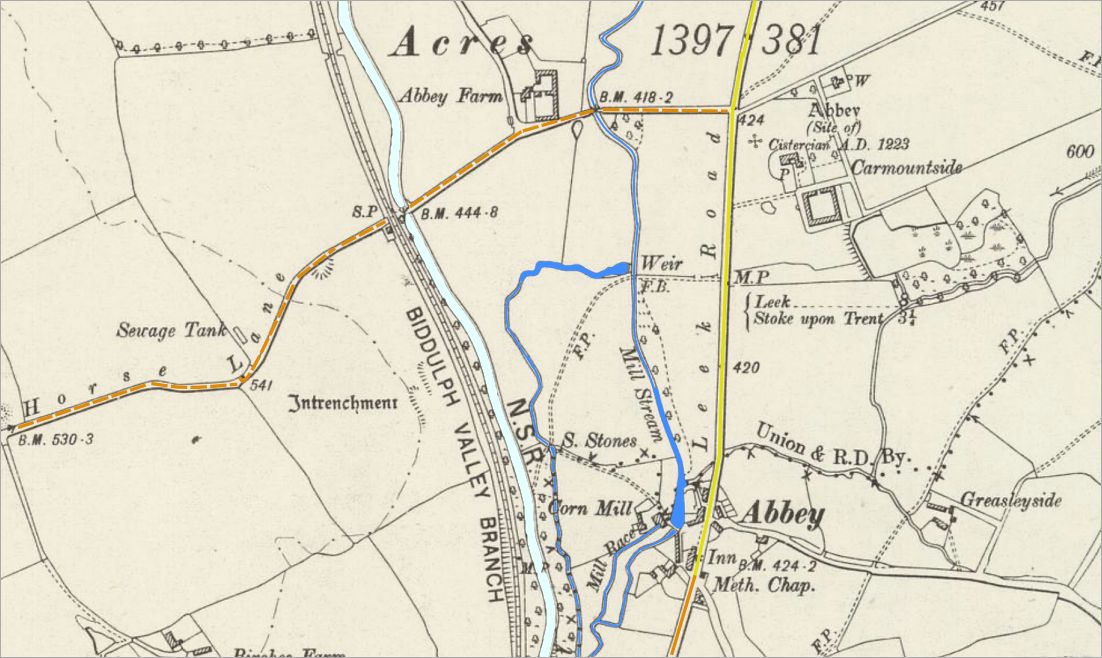
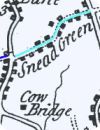
1900 OS map showing the River
Trent near to the site of the Hulton Abbey
|
The 1900 Ordnance Survey map shows how closely the medieval abbey landscape was linked to the River Trent.
-
Near the abbey site the river divides into a series of channels and loops associated with a weir, mill stream and mill race, features which controlled the flow of water for industrial and agricultural purposes.
-
The presence of a corn mill beside the river demonstrates the importance of water power to the abbey and the surrounding community over many centuries.
-
During the Middle Ages the monks of Hulton Abbey are thought to have operated a fulling mill on the Trent in connection with sheep farming and cloth production, a common activity in Cistercian communities. Water from the river would have powered machinery used in the treatment of woollen cloth.
-
A sketch of “Abbey Hulton Mill” appears in Ten Generations of a Potting Family, providing a glimpse of one of the later mill buildings associated with the site.
-
The abbey’s endowment also included fishing rights, almost certainly centred on the River Trent. Nearby fishponds supplied an important source of food for the monastic community, particularly during periods of fasting when meat could not be eaten. Traces of these medieval fishponds can still be seen near the river on the opposite side of the main road from the abbey ruins, and their memory survives today in the modern name Fishpond Way.
|
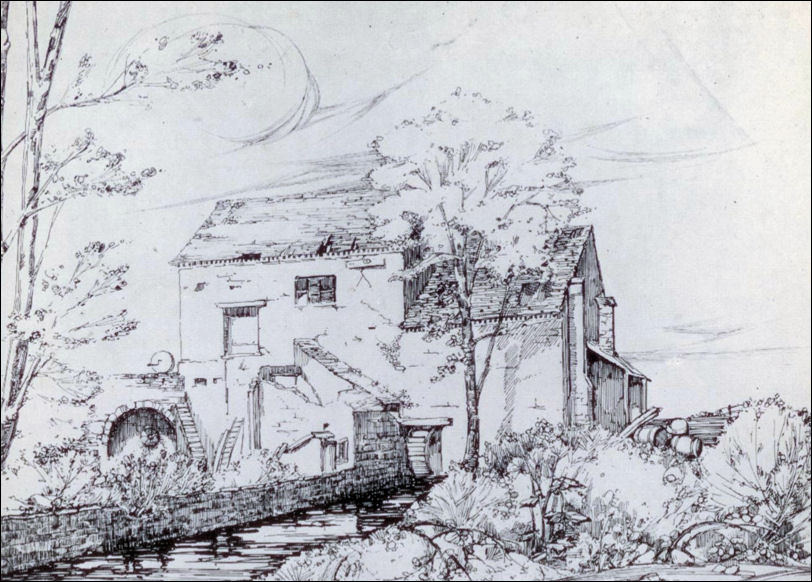
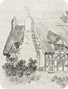
Abbey Hulton mill on the
River Trent
Ten
Generations of a Potting Family' -William Adams, an Old English Potter
|
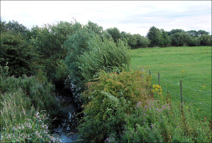
River
Trent from the bridge near Abbey Farm
A
bridge known as Abbey Bridge existed by 1733 -
this is thought to be the
bridge which carries Birches Head Road over the River Trent by Abbey
Farm.
|
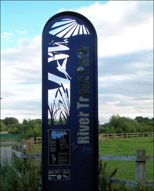
River
Trent Path
|
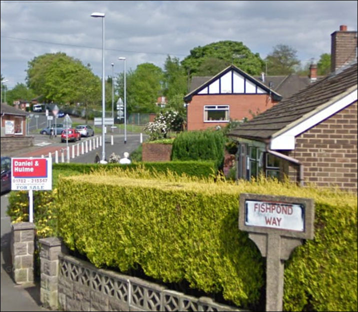
Fishpond Way off Birches Head
Road
the site of Hulton Abbey is behind the trees in the background
|
The abbey’s endowment included fishing rights, almost certainly centred on the River Trent. The monks maintained fishponds near the river to provide an important source of food for the monastic community, particularly during periods of fasting.
Traces of these medieval ponds can still be seen on the opposite side of the main road from the abbey site, while the modern name Fishpond Way preserves the memory of this earlier landscape.
|
|
Abbey Farm and the Sneyd Estate
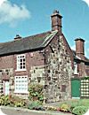
Abbey Farm, situated west of the abbey beyond the River Trent, existed by the early eighteenth century and was once home to John Bourne, grandfather of the Primitive Methodist leader Hugh Bourne. Although rebuilt largely in brick during the early nineteenth century, parts of the structure may contain earlier stonework, possibly incorporating material from the abbey ruins.
-
Following the Dissolution, the abbey estate passed through several owners before becoming firmly associated with the Sneyd family of Keele. In 1611 Sir Walter Aston conveyed the manor of Hulton to William Sneyd, after which the family became the principal landowners in the district for more than three centuries.
-
By 1838 Ralph Sneyd owned around 1,100 acres out of approximately 1,400 acres in Abbey Hulton. However, by the mid-twentieth century only Abbey Farm, Mill Farm and Birches Head Farm remained in family ownership. These were offered for sale during the break-up of the Keele estate in 1951.
-
The Sneyd family crest, featuring the scythe and fleur-de-lys, became closely associated with the district. The scythe symbolised the woodland and agricultural origins of the area, while the fleur-de-lys commemorated honours earned during the French wars under the Plantagenet kings.
|
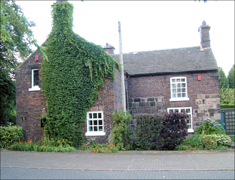
Abbey Farm on Birches Head
Road photographed
in 2012
|
Abbey Farm, a listed building
near the site of the former monastic estate, incorporating material believed to have been taken from Hulton Abbey.
|
|

Abbey Street, formerly the location of a corn mill shown on
the 1900 Ordnance Survey map at the foot of the street.
|
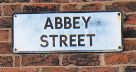
Abbey Street, one of several local streets whose names reflect the historic presence of Hulton Abbey.
The street layout and naming in this part of Abbey Hulton preserves direct links to the medieval abbey and later industrial use of the River Trent valley, including milling activity recorded on nineteenth-century maps. |
|
|
Growth of the Modern District
For centuries Abbey Hulton remained largely rural, but the district changed rapidly during the twentieth century.
-
Following the First World War, the Housing Act of 1919 encouraged large-scale council housing development across Stoke-on-Trent, and Abbey Hulton became one of the principal areas selected for expansion. New estates were built to re-house families from the older pottery towns, and the district developed quickly during the 1920s and 1930s.
-
From 1933 the Sutton Dwellings Trust was responsible for constructing 403 houses in Abbey Hulton. These homes now form a significant part of the area’s housing stock and are managed by Clarion Housing Group (as at 2026).
-
In 1922 Abbey Hulton officially became part of the County Borough of Stoke-on-Trent. Although historically within the ecclesiastical parish of Burslem, the growing community later gained its own church, St John’s, completed in 1963.
-
Today Abbey Hulton is a large suburban district, but its historic origins remain visible in the surviving abbey remains, the line of the canal and ancient transport routes.
-
Many street names also preserve links to the area’s past, reflecting the Cistercian abbey, former farms, historic roads, landowners and the Sutton Trust housing developments.
|
|
Sneyd Family
and Local Identity
The long association of the Sneyd family with the Hulton estate continued to shape the identity of the area well into the modern period.
-
Following the suppression of Hulton Abbey in 1538, the abbey and its possessions passed to the Crown. The site, together with the demesne lands in Hulton and Stoke and a coal mine in the “field of Hulton”, was leased in 1539 to Stephen Bagot of London, who had already acquired the abbey’s movable goods at the Dissolution.
-
In 1543 the Crown granted the manor of Hulton, including the abbey site and its wider estates across Hulton, Sneyd, Baddeley, Milton and Burslem, to Sir Edward Aston.
-
The manor later passed through the Aston family, and in 1611 Sir Walter Aston conveyed it to William Sneyd of Keele, bringing Abbey Hulton under the long-term ownership of the Sneyd family.
-
From this point the Sneyds became the principal landowners in the district for several centuries, with Ralph Sneyd recorded as owning around 1,100 of the 1,400 acres in Abbey Hulton in 1838.
-
Although large parts of the estate were gradually sold or developed, the family retained significant holdings into the twentieth century. Abbey Farm (150 acres), Mill Farm (26 acres) and Birches Head Farm (78 acres) remained in Sneyd ownership until the break-up of the Keele estate in 1951.
-
This long association is still reflected in the modern landscape. The Sneyd Arms public house takes its name from the family and displays their heraldic arms, including the scythe and fleur-de-lys, while the motto “Nec Opprimere, Nec Opprimi” (“Neither to oppress, nor to be oppressed”) appears beneath. Together these symbols provide a visible link between the medieval abbey estate, its post-Dissolution ownership, and the modern development of Abbey Hulton.
|
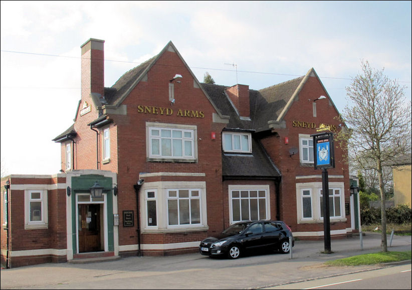
The Sneyd Arms public house
on Leek Road, abbey Hulton
|
The Sneyd Arms public house, named after the Sneyd family who owned much of the Hulton estate from the seventeenth century. |
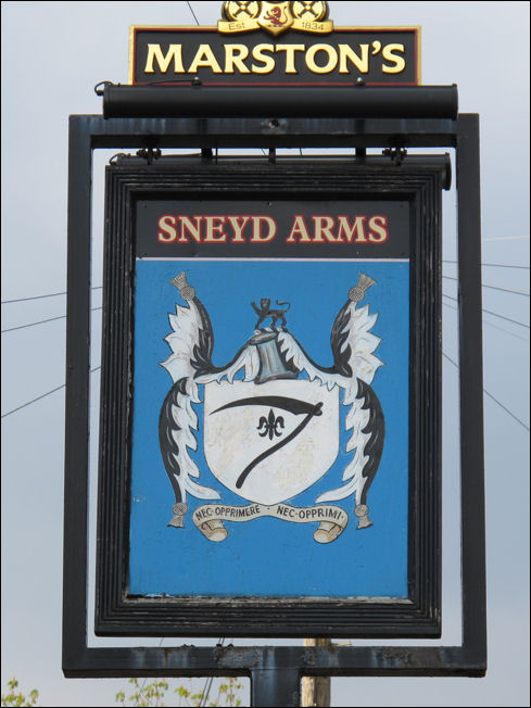
the arms of the Sneyd
Family
|
The
scythe is representative of the original woodland nature of the
district.
The
Fleur-de-lys was granted for deeds done in the French wars under the
Plantagenet Kings. The the motto
in Latin reads “Nec Opprimere, Nec Opprimi” (“Neither to oppress, nor to be oppressed”)
-
Amongst
others, the Sneyd family owned the large tract of land, in the parish of
Burslem which bears the name of Sneyd. Bradwell,
in the Manor of Tunstall was formally the chief seat of the Sneyds.
-
Hence
the scythe from the Sneyd arms is found in both the Tunstall
and Burslem
arms.
|
Sources consulted
-
Victoria County History of Staffordshire
-
Staffordshire
Past Track
-
Domesday Book – Staffordshire
-
Plot, Robert – The Natural History of Staffordshire (1686)
-
Historic maps and Ordnance Survey mapping
-
Hulton Abbey archaeological reports
-
Local canal and railway histories
-
Ten Generations of a Potting Family
-
Historic England records
|
Keep Exploring...
|
Page History:
-
Page
created: 11 March 2012
-
Last
Updated: 12 May 2026 - Significantly revised to improve structure, clarity, and navigation. Content reorganised into themed sections, with improved “On this page” and “Related pages” navigation. Supporting material has been updated and expanded.
|