|
|
|



|
A record of listed buildings in Stoke-on-Trent and surrounding districts |
| Record Summary: | |
| Grade: | II |
| Listed: | 19 April 1972 |
| Heritage Ref: | 1a |
| Location: | Abbey Hulton, Birches Head Road, Stoke-on-Trent (SJ94NW) |
| Type: | Farmhouse |
| Statement: | Early 19th-century farmhouse incorporating masonry from Hulton Abbey. |
| Source: Historic England Listing Entry | |
|
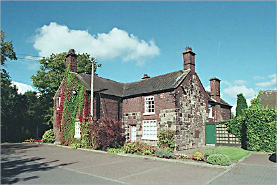
Description: Abbey Farm House is a farmhouse dating largely from the early 19th century in its present form, although the building incorporates several earlier phases of construction. It is built mainly of brick, with areas of stonework, beneath plain tiled roofs. The house is two storeys in height, with a principal range of two bays. The central entrance doorway is set within a porch and is flanked by casement windows, with additional windows above. The building has gabled ends and prominent chimney stacks. Evidence of an 18th-century phase survives within the main range, including earlier brickwork at ground-floor level and the remains of a blocked rear window. The rear wing contains substantial masonry remains showing evidence of earlier walling and a former chimney constructed in coursed and squared rubble stone. Tradition holds that some of this stonework originated from the nearby Hulton Abbey ruins. |
|
|
|
|
photo: © Mr Clive Shenton - Sept 2002 |
|
|
| Historic Map Evidence: | |
| Source: | Ordnance Survey map |
| Date: | Revised: 1937 to 1938, Published: 1940 |
| Coverage: | Junction of Birches Head Road and Leek Road |
| Location: | Abbey Hulton, Birches Head Road, Stoke-on-Trent (SJ94NW) |
| Reference: | Staffordshire XII.10; National Library of Scotland |
|
Description: This map shows Abbey Farm House within its wider landscape context, including Hulton Abbey, Birches Head Road, the canal, and the Biddulph Valley Branch railway, illustrating the layered history of the area where medieval monastic remains, post-medieval farming, and 19th-century transport infrastructure coexist within a compact landscape. |
|
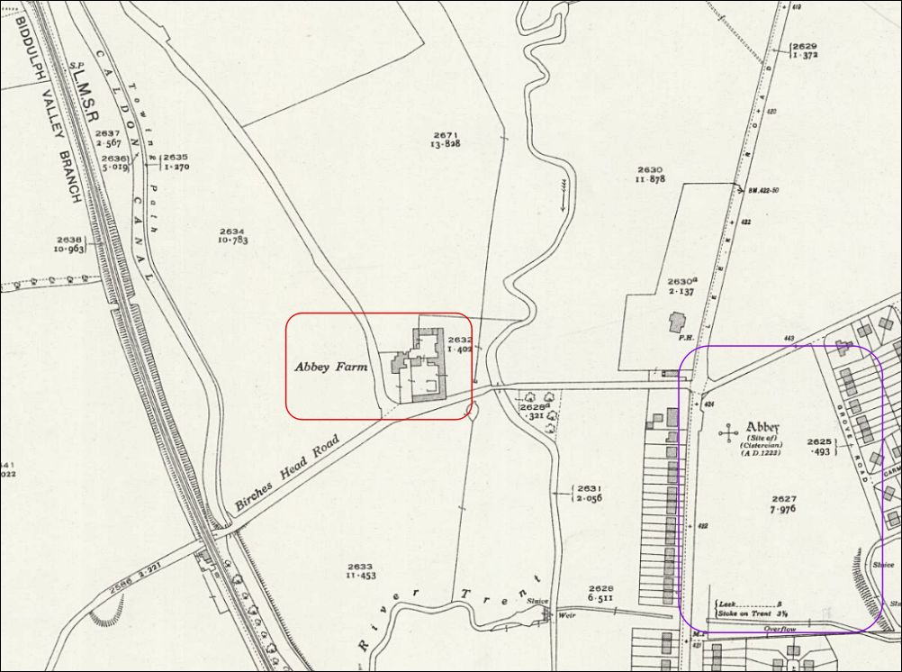
| Ordnance Survey map (published 1940) showing Abbey Farm House and surrounding historic landscape, including the site of Hulton Abbey, Birches Head Road, the Caldon Canal, and the Biddulph Valley Branch mineral railway. |
|