Maps of Stoke-on-Trent & North Staffordshire
![]()
Maps of Stoke-on-Trent &
North Staffordshire
![]() | main
map index |
| main
map index |
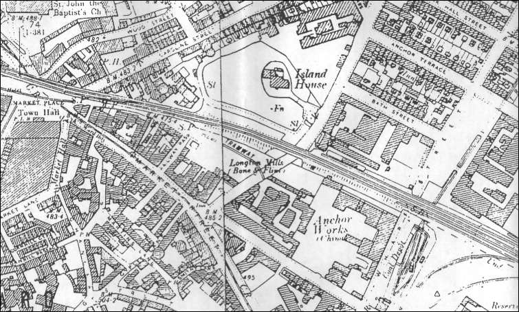
1900 OS map of Longton showing the Anchor Works location

1900 OS map of Longton showing the Anchor
Works location
To the left is the Church of St. John the Baptist and the Town Hall.
The main railway line can be seen running left to right.
In the centre bottom can be seen the Anchor china works, alongside the Longton bone and flint mills. To the right of the Anchor Works is Wharf Street and a coal depot.Located above the flint mill and Anchor Works is "Island House" - this property was called "Anchor House" on the 1832 Hargeaves map. It was the home of John Carey and an account of the home can be found with the entry for Thomas and John Carey.
![]()
![]() | main
map index |
| main
map index |