![]()
Home » Streets » Abbey Hulton Streets » Abbey Road
|
|
Home » Streets » Abbey Hulton Streets » Abbey Road |
|
|
|||||||
| Abbey Road at a glance | |
| Origin of the name | Names such as 'Abbey' and 'Abbots' in this area reflect the connection to the Hulton Abbey of 1223-1538. |
| District | Abbey Hulton » |
| Historic Area |
Formerly part of the parish of Burslem, often known as the lordship of Hulton. Became part of the County Borough of Stoke-on-Trent in 1922 |
| Connections |
To the south Abbey Road heads in the direction of Werrington Road - it is a no through road and a short footpath connects the two. To the north Abbey Road crosses Whitehouse Road then joins with Greasley Road both connect to Leek Road. |
| 1880-1900 | Abbey Road does not appear on these maps - the area where Abbey Road will eventually be laid out is open fields. |
| 1940 |
The
1940 OS map shows that Abbey Road is only laid out to the |
| 1967 |
The National Grid map shows Abbey Road completed. Streets and houses to the East have been laid out and the area to the west is open ground and two pools are marked. |
| 2026 |
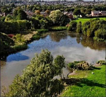
No noticeable building development has taken place since the 1967 map. The most northerly pool shown on the 1967 map has become a boggy area surrounded by trees. The southerly pool is marked as 'Jammies Fishing Pool' The rest of the area to the east of Abbey road remains open land and is marked 'Hulton Abbey Park', there is a small childrens play area. |
| Churches | Our Lady and St. Benedict Roman Catholic Church - originally built c. 1937/8; rebuilt 1962. |
| Schools | Between Abbey
Road and School Road is Abbey
Hulton Primary School (link
verified May 2026). In 2019 it became part of Orchard Community Trust. Capacity 236 pupils. |
| Collieries |
Hanley & Bucknall Colliery was located between a track which became Abbey Land and open ground which was to be where Abbey Road was laid out. Jammies Fishing Pool is situated on the site of the colliery. |
| Other features | Jammies Fishing Pool is a fishing location situated in Abbey Hulton, Stoke-on-Trent, managed by North Staffs Angling (link verified May 2026). |
|
|
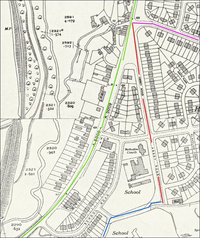
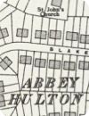
1940 OS map
On this section of the 1940 OS
map Abbey Road (red) is only laid out to the
junction with Abbey Lane (blue)
|
|
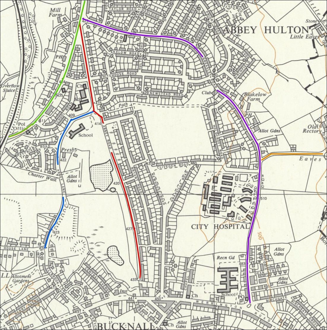
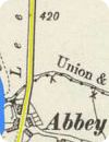
1967
map showing Abbey Road and surrounding streets
| Leek Road | - green |
| Abbey Road | - red |
| Abbey Lane | - blue |
| Greasley Road | - purple |
| Eaves Lane | - orange |
|
1967 National Grid
map The section of the 1967 map shows the 'lower' portion of Abbey Hulton, starting at the point where Abbey Road and Greasley Road both join Leek Road. Abbey Lane, Abbey Road and Greasley Road run down towards the Bucknall section of Werrington Road. The map shows the completion of the housing development which from 1933 saw the Sutton Dwellings Trust building 403 houses in the area. The houses are now managed by Clarion Housing Group. (as at 2026). |
|
|
Photos of Abbey Road
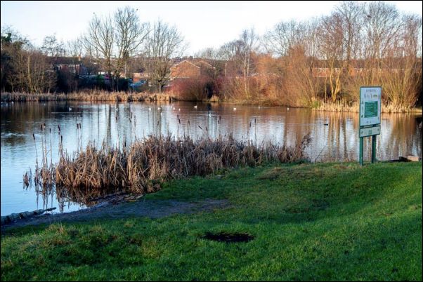 photo - Stoke Sentinel, Jan 2022 |
|
Jammies Fishing Pool
|
|
|
Keep exploring... |
|
 |
 |
| Abbey Hulton Streets | District
of Abbey Hulton |
|
|
|
|