![]()
![]()
![]()
|
|
|
|
|
|
|
|
|
Introduction to the maps - The following Ordnance Survey maps show a section of Abbey Hulton from 1880, 1900 and 1940 show the rapid development of Abbey Hulton from a largely rural and industrial landscape into a growing residential suburb of Stoke-on-Trent.
Corresponding locations on all maps have been marked using matching coloured markers. |
|
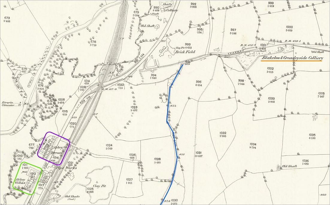
1880 OS map In 1880 Abbey Hulton was still largely rural with collieries, tramways, scattered housing and farmland dominating the landscape. Abbey Lane, shown in blue, appears only as an unnamed track leading from the Hanley & Bucknall Colliery to a tramway connected with the Blackelow and Greasleyside Colliery - both these names would later be reflected in housing streets. Leek Road already formed the main route through the area, accompanied by the Caldon Canal, River Trent and the Biddulph Valley Branch railway. Abbey Villas and Abbey Terrace can both be seen fronting Leek Road. |
|
|
|
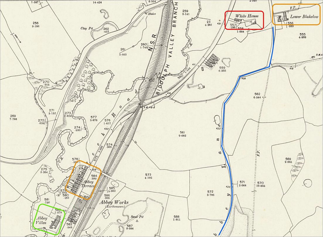
1900 OS map By 1900 the unnamed track had become Abbey Lane. The Hanley & Bucknall Colliery is still in existence but by 1924 was marked as 'disused' and the earlier Blackelow and Greasleyside Colliery had disappeared and been replaced by two buildings named White House and Lower Blakelow. The map still shows Abbey Hulton as largely open countryside, some industrial activity (Abbey Works - an earthenware pottery) and transport links continued to shape the area. Many later street names can already be traced in these earlier features and place names. |
|
|
|
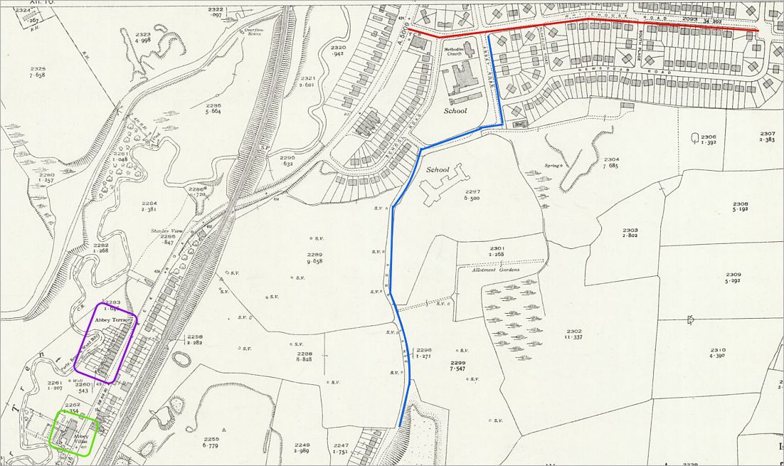
1940 OS map The 1940 map shows the beginning of the major interwar housing development which transformed Abbey Hulton during the 1920s and 1930s. Housing had appeared at the lower end of Abbey Lane and new streets were beginning to spread across former colliery and farmland sites. At the upper end of Abbey Lane a school and several new residential streets are shown, including Whitehouse Road and Greasley Road, both reflecting earlier local names already visible on the older maps. The Hanley & Bucknall Colliery had disappeared by this time and the district was rapidly becoming suburban in character. |
For the wider history of the district see the Abbey Hulton district history page.
|
|